10 Best Day Trips from Reykjavik in 2026
Iceland might feel like the edge of the world, but from Reykjavik, its most jaw-dropping landscapes are surprisingly close. With a campervan or rental car, you can reach black sand beaches, glacier hikes, volcanic valleys, and geothermal hot springs – all before dinner.
Whether you're following the well-worn path of the Golden Circle or venturing deep into the highlands toward Thórsmörk or Kerlingarfjöll, these 10 day trips prove that you don’t need a full road trip to experience Iceland’s wild beauty.
1. The Golden Circle
Even with just one day to spare, you can experience some of Iceland’s most famous landscapes. The Golden Circle is a 230 km (142 mi) loop from Reykjavik that packs in powerful waterfalls, an erupting geyser, and a rift in the Eurasian and North American tectonic plates you can walk through. A classic Iceland day trip – easy, iconic, and endlessly impressive.
What to Expect
The Golden Circle is generally considered to be made up of three sights, all easy to reach in a single day trip:
- Thingvellir National Park – This UNESCO site is where you can stroll between tectonic plates and see the birthplace of Iceland’s democracy.
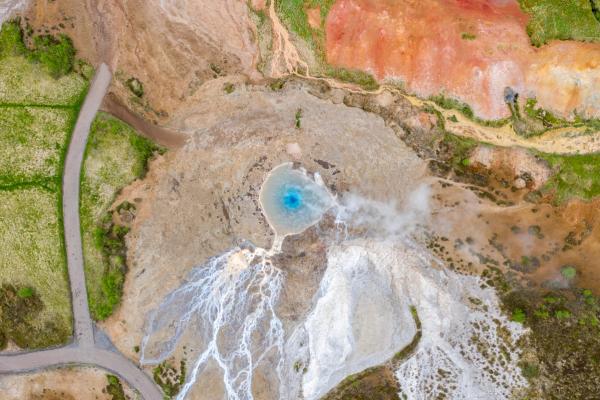
- Geysir Geothermal Area – Home to Strokkur, a lively geyser that erupts every 5 minutes or so, often reaching 30 meters high.
- Gullfoss Waterfall – A roaring two-tiered cascade where glacial meltwater from Langjökull plunges into a rugged canyon – this is one of Iceland’s most impressive waterfalls.
Top Reasons to Visit
The top reason to visit the Golden Circle is to easily see some of Iceland’s dramatic natural attractions and explore its rich history in an easy drive from Reykjavik. For many, this is the ideal first day out of the city, a great introduction to the countryside and what you can expect elsewhere. Plus, it’s easily achievable in a day, with all three sights not very far from Reykjavik.
The Golden Circle is also one of the few day trips that remains pretty much open year-round. Each season paints it differently; winter brings snow and the Northern Lights; summer stretches on with endless daylight and fields of lupines.
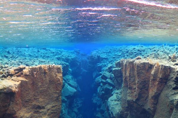
Thingvellir National Park is also home to the Silfra Fissure – the only place in the world where you can snorkel or dive between the tectonic plates.
How to Get There
From Reykjavik, follow Route 1 (Ring Road) as it heads out of the city to the northeast. You’ll then turn right onto Route 36 toward Thingvellir, the first stop of the Golden Circle. The full Golden Circle loop, including Thingvellir, Geysir, and Gullfoss, is around 230 km (143 mi) and takes 6–8 hours with stops. Roads are paved and open year-round, suitable for all vehicles.
2. The South Coast
Iceland’s impressive South Coast is another one of the most popular day trips from Reykjavik, a region where fire and ice collide with stunning results. The nature here is unlike anything else in the world, and the huge landscapes will have you pulling over more than once just to take it all in.
What to Expect
Route 1, the Ring Road, runs straight through this region, linking the capital with glaciers, waterfalls, and black sand beaches. The scenery shifts fast: flat farmlands give way to towering cliffs, lava fields, and crashing Atlantic waves, with the little hamlet of Vik in the middle of it all, a busy little place at the southern tip of the country.
Top Reasons to Visit
This stretch of coast is packed with highlights, all within reach of a day’s drive:
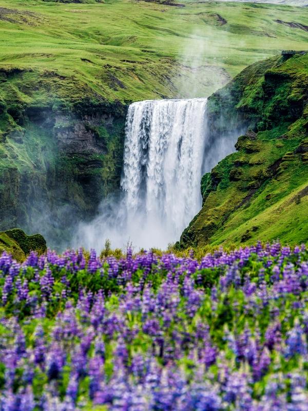
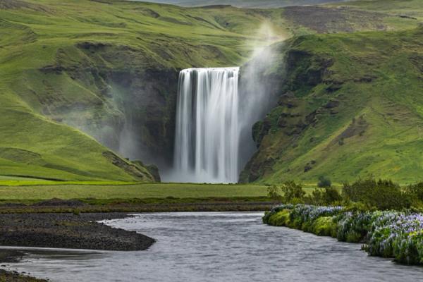
- Seljalandsfoss and Skógafoss – Two of Iceland’s best-loved waterfalls, one you can walk behind, the other thunderous and towering.
- Reynisfjara Beach – Jet-black sand, sea stacks, and basalt columns create a surreal coastal scene at the country’s most famous black sand beach.
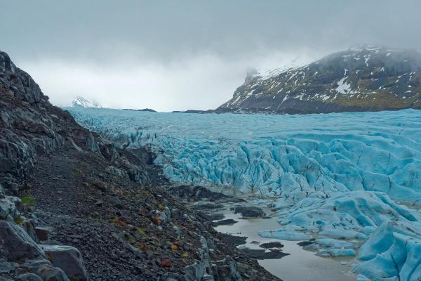
- Sólheimajökull Glacier – A chance to walk on glacial ice just off the highway, join an ice climbing tour, or kayak on the lagoon that’s emerging as the glacier retreats.
- Vík – Iceland’s southernmost village, surrounded by cliffs and puffin nesting spots (in season).
It’s one of the easiest ways to experience Iceland’s wild diversity in a single outing.
How to Get There
Simply follow the Ring Road southeast from Reykjavik. Seljalandsfoss is about 128 km (80 mi) away, Skógafoss at 150 km (93 mi), and Vík around 190 km (118 mi). Plan 10–12 hours for the round trip with stops. The road is paved and accessible year-round, and there are plenty of facilities along the way.
3. Snæfellsnes Peninsula
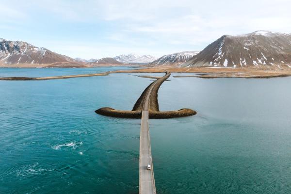
Nicknamed “Iceland in Miniature,” the Snæfellsnes Peninsula offers a little bit of everything: lava fields, black and white sand beaches, dramatic sea cliffs, and a glacier-topped volcano. It’s an ideal day trip for travelers who want varied Icelandic landscapes without having to loop around the entire Ring Road.
What to Expect
This roughly 90-kilometer-long (55 mile) peninsula juts out west above the town of Borgarfjörður. The peninsula is crowned by the Snæfellsjökull glacier-volcano, made famous in Jules Verne’s Journey to the Center of the Earth. The terrain is wildly varied, from steep mountains that cut through mossy lava fields to crashing waterfalls to twisted sea cliffs, with quiet fishing villages clinging to the rugged coastline.
You’ll also find one of Iceland’s three national parks here: Snæfellsjökull National Park, which protects the glacier and its surrounding lava formations.
Top Reasons to Visit
This is one of those drives where the scenery never stops changing, from mountains to beaches to lava fields, all in a single loop.
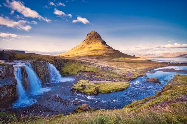
- Kirkjufell and Kirkjufellsfoss – One of the most photographed mountains in Iceland, especially beautiful at sunrise or under the Northern Lights.
- Búðir – A tiny black church surrounded by windswept lava and golden grasslands.
- Arnarstapi and Hellnar – Coastal hamlets with basalt arches, sea cliffs, and walking trails.
- Djúpalónssandur – A black pebble beach scattered with shipwreck debris.
- Ytri Tunga – A seal-watching beach with golden sands.
With fewer crowds than the Golden Circle or South Coast, it’s a favorite among photographers and road-trippers looking for a peaceful but striking route.
How to Get There
Head north on Route 1 to Borgarnes, then follow Route 54 onto the peninsula. It’s about 150 km (93 mi) one way and takes 2–2.5 hours. Roads are paved, but some coastal detours are gravel. A full loop with stops takes 8–10 hours; a big day, but achievable.
4. Thórsmörk Valley
Tucked between three glaciers in the southern highlands, Thórsmörk (Þórsmörk) is one of Iceland’s most dramatic and remote landscapes. It's a lush, mossy valley surrounded by volcanic ridges and braided rivers, best suited to adventurous day trippers and those craving hikes through landscapes carved by fire and ice. One of the most rewarding highland day trips in Iceland.
What to Expect
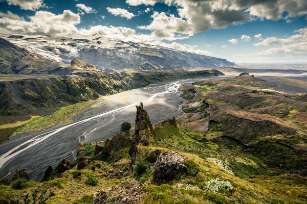
Named after the Norse god Thor, Thórsmörk is a sheltered valley carved between the glaciers Eyjafjallajökull, Mýrdalsjökull, and Tindfjallajökull. This oasis of green is laced with hiking trails, riverbeds of black sand, and volcanic features left behind by eruptions and glacial floods.
The area also marks the endpoint of two of Iceland’s most famous multi-day treks: Fimmvörðuháls and Laugavegur.
Top Reasons to Visit
Thórsmörk feels worlds away from Reykjavik, but can be done as a day trip. These are the highlights of an excursion to this remote area.
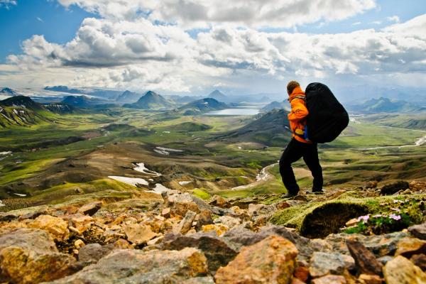
- Spectacular hiking – Trails range from easy viewpoints like Valahnúkur to rugged routes between craters.
- Wild scenery – Lush birch forests, towering canyons, and black sand braided with glinting glacial rivers, with the giant ice caps rising above it all.
- True isolation – Few places this close to Reykjavik feel so completely off the grid.
It’s a favorite among nature lovers and experienced hikers looking for something more offbeat than the typical day trip circuit.
How to Get There
Thórsmörk is notoriously one of the most difficult places to reach; it requires driving on F-Roads (you’ll need a 4x4), but even then, the rivers that you need to cross are amongst the most dangerous in the country. Unless you're a seasoned river crosser with serious gear, leave the driving to the pros – take the Highland Bus. This departs Reykjavik early in the morning, arriving at Thórsmörk mid-morning. Then, the bus back to Reykjavik leaves the various mountain huts in Thórsmörk between 7:15 and 8:15 PM.
5. Kerlingarfjöll
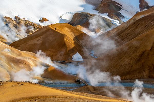
Deep in Iceland’s central highlands, Kerlingarfjöll delivers a surreal mix of steaming valleys and snow-dusted peaks. Once a little-visited place apart from the adventurous, this geothermal mountain range is now protected as a nature reserve and is becoming increasingly popular, especially as an easier-to-reach alternative to Landmannalaugar.
What to Expect
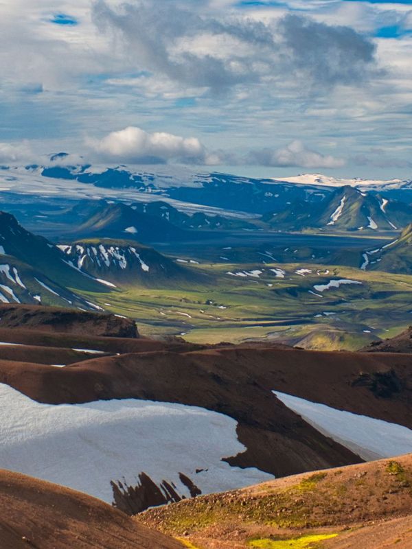
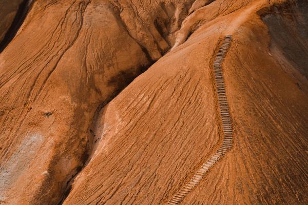
Kerlingarfjöll sits between the Langjökull and Hofsjökull glaciers, about 700 meters above sea level. Volcanic in origin, the rhyolite mountains glow with rusty reds, golds, and greys, especially when steam rises from the geothermal vents of Hveradalir, a steaming valley that smells like sulfur and looks like Mars.
The region covers over 360 square kilometers and became a designated nature reserve in 2017. Its name means "Old Woman’s Mountains," drawn from a legend about a stone-shaped troll hidden in the peaks.
Top Reasons to Visit
Kerlingarfjöll offers something rare: highland wilderness that’s still accessible in a single day from Reykjavik.
- Otherworldly terrain – Colorful hills streaked with steam vents, bubbling mud pools, and mineral-rich hot springs.
- Diverse hiking – From short loops to challenging climbs, the trail network suits a range of skill levels.
- Peace and space – Fewer visitors than South Coast or Golden Circle destinations.
- Photographic drama – Stark contrasts between snow patches and geothermal colors make for unforgettable shots.
It’s one of the best places to experience Iceland’s raw, untamed interior without committing to a multi-day trek.
How to Get There
Accessible along Route 35, this is a summer-only 4x4 trip. You’ll first want to drive to Gullfoss Waterfall at the very end of the Golden Circle. From here, Route 35 begins; after about 70 km (43 mi), turn onto F347 to reach Kerlingarfjöll. Total distance is around 200 km (124 mi), taking 3.5 hours. Only accessible in summer by 4x4 vehicle due to rough, unpaved highland roads.
6. Landmannalaugar
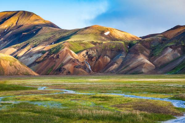
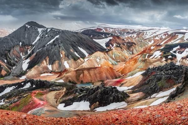
Landmannalaugar contains some of Iceland’s most surreal landscapes, where steaming hot springs meet rainbow-colored mountains in the remote southern highlands. It’s a bucket-list destination for hikers around the world, and doable as a long but rewarding day trip from Reykjavik in summer with a 4x4.
What to Expect
Located in the Fjallabak Nature Reserve, Landmannalaugar is a geothermal wonderland defined by its rhyolite mountains, volcanic craters, and lava fields. The area’s name means “People’s Pools,” and it refers to the naturally heated hot springs at the base of the Laugahraun lava field, formed in 1477.
It’s also the northern starting point of the Laugavegur Trail, one of Iceland’s most famous multi-day hikes. For day trippers, it also contains plenty of incredible trails to tackle, touring the spectacular landscapes and delivering you back to the campsite in time for the long drive back to the city.
Top Reasons to Visit
Landmannalaugar is a dream for hikers who don’t mind getting a little muddy for their views.
- Unreal color palette – Red, pink, yellow, green, and blue tones swirl through the hills, thanks to mineral deposits in the rock.
- Geothermal bathing – The natural hot pool stays warm year-round and sits beside a glacial river.
- Epic hiking – Choose from gentle walks or steep summits like Bláhnúkur and Brennisteinsalda.
- Volcanic drama – The region’s lava fields, steam vents, and craters feel otherworldly.
Whether you’re dipping into a short trail or aiming for a summit, the terrain here delivers.
How to Get There
It’s possible to drive to Landmannalaugar with your own 4x4; regular cars aren’t allowed on the F-Roads. From Reykjavik, drive southeast on Route 1 to Hella or Selfoss, then connect to F26 and F208 (approaching from the north). Total distance is approx. 190 km (118 mi), taking 3.5–4.5 hours.
7. Reykjanes Peninsula
Just outside Reykjavik lies a landscape shaped by fire, steam, and shifting tectonic plates. The Reykjanes Peninsula is often overlooked by travelers rushing elsewhere, but it’s one of the easiest places to witness Iceland’s raw volcanic power up close.
What to Expect
This southwestern corner of Iceland sits directly on the Mid-Atlantic Ridge, where the North American and Eurasian plates slowly pull apart. It’s one of the few places on Earth where you can actually walk across a rift between continents. The landscape could be mistaken for another planet, with gnarly lava fields, steaming geothermal areas, and craggy coastlines.
Reykjanes also holds UNESCO Global Geopark status, thanks to its 55 distinct geo sites. Despite being home to Keflavík International Airport and the Blue Lagoon, the rest of the peninsula feels wild and wonderfully untouristed.
Top Reasons to Visit
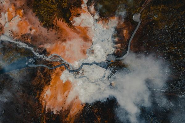
- Krýsuvík / Seltún – A colorful geothermal area bubbling with hot springs, mud pots, and sulfur-stained hills.
- Gunnuhver – Iceland’s largest mud pot, where steam billows sky-high in a constantly shifting mist.
- Bridge Between Continents – A symbolic footbridge spanning the rift between two tectonic plates.
- Kleifarvatn – A deep, mysterious lake whose shoreline shifts after earthquakes.
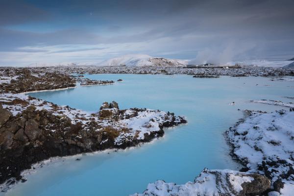
- Blue Lagoon – The famous milky-blue spa is here too, just 45 minutes from Reykjavik and the perfect end to a day trip around the area.
It’s a compact region that offers a little bit of everything: geology, hot springs, sea views, and solitude.
How to Get There
Take Route 41 southwest from Reykjavik. Most of the highlights, including Krýsuvík, Gunnuhver, and the Bridge Between Continents, are within 45–60 minutes (69 km / 43 mi). Roads are paved and open year-round. Some geothermal sites require short gravel detours, but nothing crazy.
8. Sólheimajökull
Wedged between two volcanoes on Iceland’s southern coast, Sólheimajökull is one of the most accessible glaciers in the country. If you’ve ever dreamed of walking on ice, this is one of the easiest places to do it, even as a day trip from Reykjavik.
What to Expect
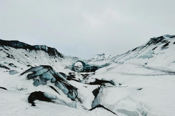
Sólheimajökull is an outlet glacier of Mýrdalsjökull, Iceland’s fourth-largest ice cap. It flows down from the mountains between Katla Volcano and Eyjafjallajökull, creating a frozen tongue of ice scarred with black ash, blue crevasses, and sculpted ridges.
Over the years, volcanic eruptions and warming temperatures have shaped and shrunk this dynamic glacier, leaving behind a raw and otherworldly landscape that changes with every season.
Top Reasons to Visit
A Sólheimajökull day trip offers a rare opportunity to get up close to one of Iceland’s disappearing glaciers, and it’s only a couple of hours from your base in Reykjavik.
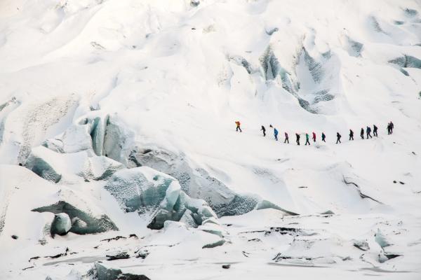
- Glacier hiking – Strap on crampons and explore ice formations, ridges, and moulins with a guide.
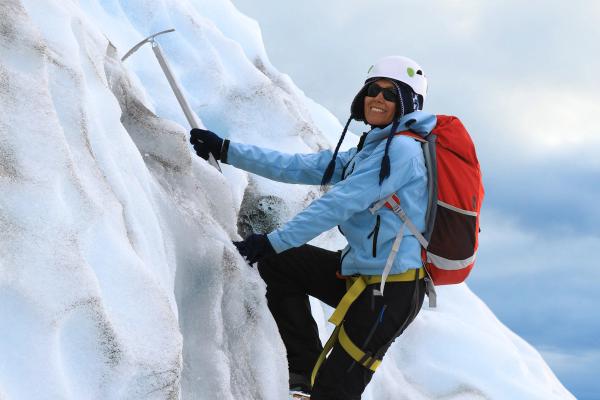
- Ice climbing – For the adventurous, this is one of the few places in Iceland to try climbing vertical ice walls.
- Kayaking – In summer, paddle across the meltwater lagoon at the base of the glacier for a new perspective.
- Easy access – No need to venture deep into the highlands, as Sólheimajökull sits just a short detour off the Ring Road near Skógafoss Waterfall.
- South Coast – Due to its location, you can also combine a day trip to the glacier with stops at the famous waterfalls Seljalandsfoss and Skógafoss on your way to and from Reykjavik.
How to Get There
Follow Route 1 southeast from Reykjavik in the direction of Hveragerði, Selfoss, etc. You’ll follow the ring road until just past Skógafoss, when you’ll turn left onto Road 221. The glacier parking area is about 158 km (98 mi) from Reykjavik, just under 2.5 hours. Road 221 is gravel but passable for most vehicles. Parking and glacier access are clearly marked; you also need to pay for parking here.
9. Katla Ice Cave
Beneath a mighty glacier in South Iceland lies one of the country’s most striking natural wonders: the Katla Ice Cave. Formed by volcanic forces and shaped by ancient ice, this dramatic cave offers a surreal, year-round glimpse into the heart of Iceland’s "Fire and Ice" identity.
What to Expect
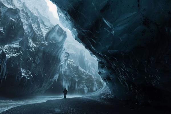
The cave sits beneath Kötlujökull, an outlet glacier of Mýrdalsjökull, with the powerful Katla volcano rumbling underneath. Layers of glacial ice streaked with volcanic ash give the cave its signature look – dark bands twisting through translucent blue walls like something out of fantasy fiction.
Unlike most of Iceland’s ice caves, which are only accessible in winter, the Katla Ice Cave is open year-round thanks to its location and stable structure.
Top Reasons to Visit
- Striking contrast of ice and ash – The cave walls are laced with “dragon glass” textures formed by centuries of eruptions.
- Accessible year-round – One of the few ice caves in Iceland that can be visited in both summer and winter.
- Photography heaven – A favorite for photographers chasing light and texture.
With professional guides and proper gear, it’s a safe, unforgettable journey into Iceland’s volcanic underworld.
How to Get There
Drive Route 1 southeast for about 187 km (116 mi) to Vík. Most tours start in Vík, or you can also join them from Reykjavik and make the journey to Vík in a tour bus. Regular vehicles can't access the cave itself; only modified super jeeps can handle the terrain. The main road to Vik is paved and open year-round.
10. Hvalfjörður, Glymur & Hvammsvík Hot Spring
Just north of Reykjavik, Hvalfjörður (“Whale Fjord”) is a quiet, scenic escape that many travelers skip in favor of the faster tunnel route. But as a day trip from Reykjavik, touring this long and deep fjord rewards travelers with waterfalls, wild landscapes, and one of Iceland’s most tranquil hot spring experiences.
What to Expect
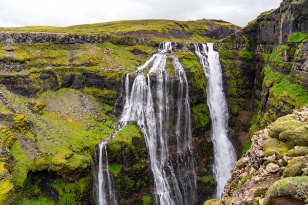
Hvalfjörður stretches inland for about 30 kilometers, flanked by steep mountains and calm waters. The area saw military use during World War II, but today it’s all about solitude, hiking, and soaking in nature. It's also the setting for Glymur, Iceland’s second-highest waterfall, tucked at the fjord’s far end.
Driving the fjord takes about 45 minutes without stops, but plan for more. Between hiking trails, viewpoints, and geothermal pools, it’s a full day well spent.
Top Reasons to Visit
- Glymur waterfall hike – A 2.5-to-3.5-hour round-trip trek through birch forest, river crossings, and along canyon cliffs to reach a spectacular 198-meter drop.
- Fjord scenery – Peaceful roads with minimal traffic, winding past sea cliffs, fields of lupine in spring and summer, and old whaling stations.
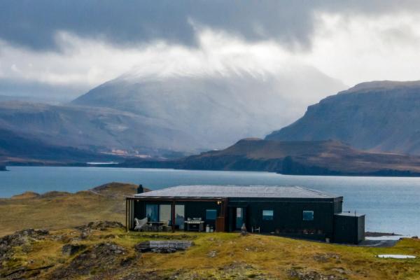
- Hvammsvík Hot Springs – Eight oceanside geothermal pools that rise and fall with the tide. Soak just steps from the North Atlantic while surrounded by rugged coastlines and mountains.
- Stormur Bistro – The on-site restaurant at Hvammsvík serves local seafood and warm Nordic dishes, perfect after the Glymur hike.
This is an ideal loop for travelers seeking a slower, less touristy experience near Reykjavik, with equal parts effort and ease.
How to Get There
From Reykjavik, take Route 1 north out of the city. After 25 km (16 mi), exit onto Route 47 to follow the fjord. Glymur trailhead is about 70 km (43 mi), and Hvammsvík is around 55 km (34 mi) from Reykjavik. Roads are paved and open year-round, barring any adverse weather. Allow 1–1.5 hours each way for a relaxed day trip.
Choosing the Right Day Trip from Reykjavik
From beginner-friendly scenic drives to rugged highland adventures, Reykjavik is the perfect base for exploring Iceland’s wild side. Whether you’re chasing waterfalls, soaking in hot springs, or trekking volcanic valleys, each of these day trips reveal a different side of what makes Iceland unforgettable.

