Discovering Gljúfrabúi, the Hidden Waterfall
South Iceland is a region that has become one of the most popular destinations for travelers visiting the country. The main reason is that this part of Iceland is well-connected by road, close to Reykjavik, and, above all, is full of natural wonders. Many of the attractions in this area are well known and frequented by tourists. However, others, despite being close to them, remain almost hidden and feel like secrets.
One of them is Gljúfrabúi, a waterfall that feels like a discovery every time you visit. This place is, in fact, inside a narrow canyon and can’t be seen from the outside. It’s really close to Seljalandsfoss, one of the most famous waterfalls in all of Iceland. For this reason, it’s an easy addition to a road trip through the south of the country. It’s easy to access and there are many camping sites nearby, so you can go and rest after a day exploring the area. Let’s see everything you need to know about this beautiful landmark.
Key Takeaways
- Gljúfrabúi is a 40-meter waterfall located in South Iceland.
- It’s inside a narrow canyon, and it’s impossible to see it from the outside.
- It’s a couple of minutes away from Seljalandsfoss, one of the most famous waterfalls in Iceland.
What is Gljúfrabúi?
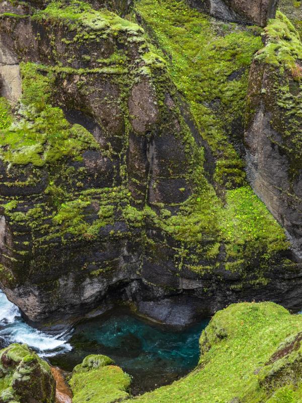
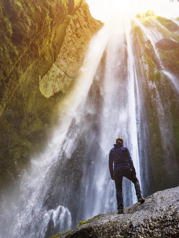
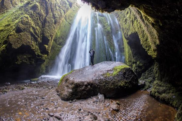
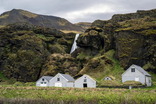
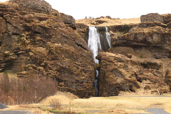
Gljúfrabúi is a 40-meter (131-foot) waterfall in Iceland's South Coast, just a short walk from the iconic Seljalandsfoss. Its defining feature is its location inside a narrow gorge, where the Gljúfurá River pours over a cliff into a pool below. Unlike more open waterfalls, Gljúfrabúi is partially hidden behind a massive basalt rock face, and that’s why visiting it feels like uncovering a hidden treasure. To see it up close, you’ll need to make your way through a shallow stream at the canyon’s entrance. At the end, a wide chamber opens up, its walls covered in green moss, creating a quiet but impressive image. If the sun is out, it creates an interplay of light, and that’s why it is a favorite among photographers.
The waterfall’s formation is a great example of how, like in many other places in Iceland, different forces have combined to sculpt the landscape. Gljúfrabúi is the result of volcanic activity and glacial melt. The Gljúfurá River, fed by springs in the nearby highlands, carved the gorge over centuries, revealing different layers of basalt and softer rocks. There are ancient farming settlements nearby, which suggests that early Icelanders were aware of its existence long before it became a tourist attraction.
For visitors, it’s a chance to discover a place that is not in every travel guide. The sense of seclusion, compared to other busier sites, makes it a great stop in a road trip through Iceland, especially for those travelers looking for something special.
Facts about Gljúfrabúi
Here’s some general information about Gljúfrabúi.
Height
Gljúfrabúi drops about 40 meters (131 feet) from a cliff, with water coming from the Gljúfurá River, which starts near Tröllagil (Troll Gorge) in the Hamragarðaheiði highlands.
Origin
Unlike its neighbor Seljalandsfoss, fed by the larger Seljalandsá River from Eyjafjallajökull’s glacier, Gljúfrabúi flows from a spring. This creates a gentler, more graceful cascade. It’s not as powerful as other waterfalls, but its allure resides in its hidden location inside the gorge.
Name’s Meaning
The name “Gljúfrabúi” breaks down to “Gljúfur” (canyon) and “búi” (dweller) in Icelandic. So, the name could be translated to “Canyon Dweller.” It captures how the waterfall seems to live within the gorge, hidden from plain view until you go inside. It is sometimes called Gljúfrafoss, as foss means waterfall in Icelandic. That would mean “the canyon waterfall.”
Geology
Gljúfrabúi is inside a canyon made of basalt, which indicates the volcanic origin of this part of the country. The walls are covered in green moss, a plant that uses the humidity trapped inside volcanic rocks to survive. Over time, the erosion of the glacial waters shaped the narrow gorge. These waters are mainly from snowmelt, which is why the river flow is at its highest in late spring and early summer. In winter, the waterfall partially freezes, giving it a completely different look, adding even more textures to the scene.
Where’s Gljúfrabúi and How to Get There
Visiting Gljúfrabúi is pretty straightforward. The waterfall is just off the Ring Road (Route 1), the most important road in Iceland.
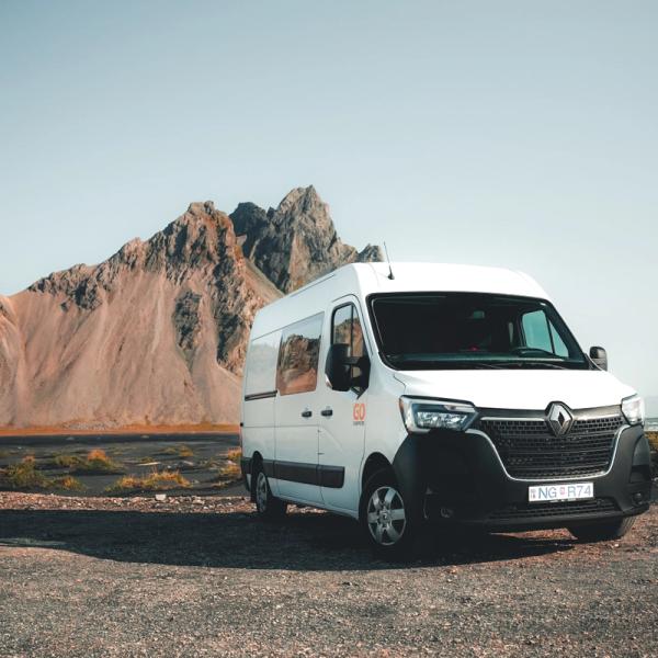
The best way to explore this area, as well as to make a road trip through the country, is to rent a campervan. This way, you’ll have freedom to go anywhere you like and also a place to sleep at night.
From Reykjavík, head east on Route 1 for 128 kilometers (80 miles), a drive of about 1 hour 45 minutes. You’ll pass through Hveragerði and Selfoss, then Hvolsvöllur. After crossing the Markarfljót River bridge, turn left onto Route 249, following signs for Þórsmörk. Drive on it for 1 kilometer (0.6 miles) till you see signs for Gljúfrabúi. There’s a parking area and, from there, you just have to walk 300 meters (0.2 miles) to reach the gorge’s entrance.
Alternatively, you can skip the turn to Route 249 and continue on Route 1 for 300 more meters. Then turn left onto the road that goes to Seljalandsfoss if you want to visit that waterfall first. You can leave the car in the parking lot there and go to Gljúfrabúi on foot. Or take the car again and drive to the other parking area. But know that both parking areas require you to pay a small fee.
All the roads leading there are paved and in good condition. The waterfall can be visited all year, but winter can make the conditions for driving difficult.
What to See and Do Near Gljúfrabúi
South Iceland is one of the most visited regions in the country, packed with waterfalls, glaciers, beaches, and volcanic sites, all of them well connected.
The Ring Road, the main road in the country, crosses the region, making it very easy to go from one stop to the next. If you rent a campervan, you’ll have the freedom to create an itinerary through the region.
Seljalandsfoss
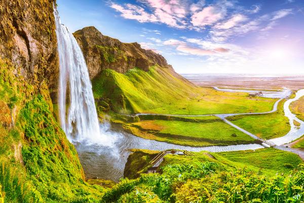
Just 300 meters (0.2 miles) south of Gljúfrabúi, Seljalandsfoss is a 60-meter (197-foot) waterfall, one of the most iconic in Iceland. Its most distinctive feature is that there’s a path that goes behind the curtain of water, giving a point of view that’s unique. It’s right off the Ring Road, with parking for a small fee and restrooms nearby. The short trail to Gljúfrabúi starts here, making it a natural first stop before heading north to the hidden waterfall.
Many tourists come only to see Seljalandsfoss, but the combination of the two makes it one of the best travel experiences in the region.
Sólheimasandur Plane Wreck
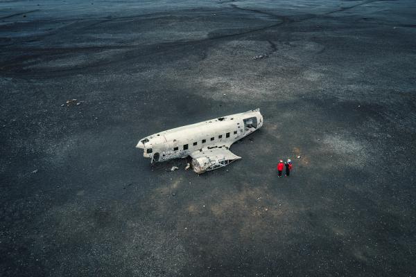
There’s a place by the southern coast that is a surreal sight. In 1973, a Douglas DC-3 plane belonging to the U.S. Navy crashed in Sólheimasandur. The crew survived, but the remains of the fuselage were left behind. With time, it has become an increasingly popular place, as travelers go attracted by the contrast created by the white plane and the black volcanic sand. There’s a parking area off the Ring Road where you can leave the campervan.
From there, it’s a 4-kilometer (2.5-mile) flat hike, which takes about 45 minutes each way. There are no facilities, so bring water and wear sturdy shoes, as the trail is a bit uneven. It’s perfect for photos and a bit of modern history.
If you prefer not to walk, a shuttle service operates daily between the parking lot and the black sand beach.
Skógafoss
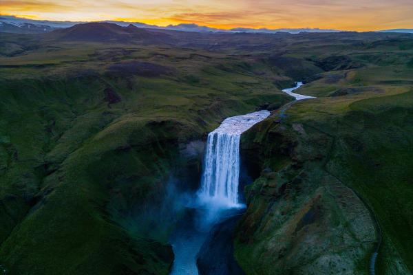
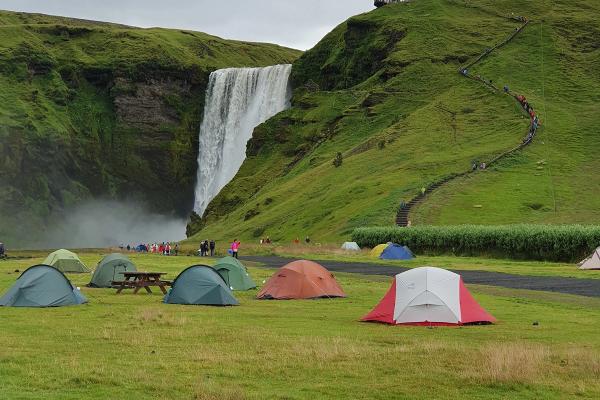
If you go a bit further east on the Ring Road, about 30 kilometers (19 miles) from Gljúfrabúi, you’ll reach Skógafoss, another amazing waterfall. This mighty cascade is 60 meters (197 feet) tall and 25 meters (82 feet) wide.
There’s a staircase that goes all the way up to the top, from where you can enjoy sweeping views of the coast and highlands. But be warned, it’s 500 steps, so pace yourself.
There’s a legend attached to this place that says that a Viking pirate hid a treasure behind the falls.
Kvernufoss
Similar to what happens with Seljalandsfoss and Gljúfrabúi, there’s a lesser-known waterfall very close to Skógafoss. Kvernufoss drops 30 meters (98 feet) into a narrow gorge. Like in Seljalandsfoss, there’s also a path that goes into a cave behind the waterfall. There’s a path that starts at the Skógar Museum parking lot and takes around 20 minutes to reach Kvernufoss. The trail can get muddy if it has rained before, so come prepared if that’s the case.
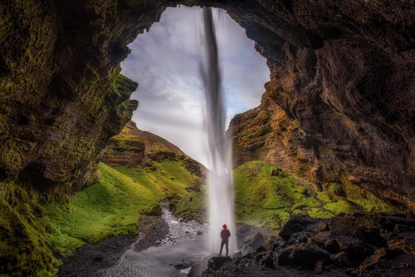
Þórsmörk
Þórsmörk is a highland valley named after the Norse god Thor. It’s an area of strong contrasts, with birch forests, rivers, and trails to discover every corner of this amazing valley. Summer is the best time to go, as it’s necessary to travel some F-roads to get there, and some of these roads close in winter due to heavy snow. The valley’s trails lead to stunning views of volcanoes and canyons, perfect for a deeper adventure.
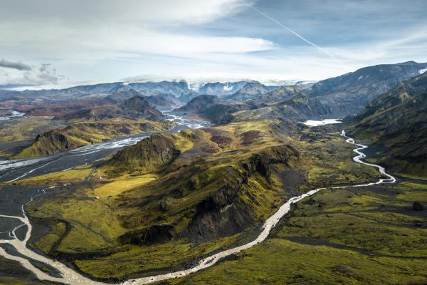
Eyjafjallajökull
About 15 kilometers (9 miles) north, Eyjafjallajökull is the glacier-capped volcano famous for its 2010 eruption. The visitor center near the base shares details on the event’s impact and volcanoes in general. There are guided glacier hikes available that offer a closer look, but never go without a professional guide. It’s an easy detour for campervan travelers, accessible year-round, though winter options may be limited.
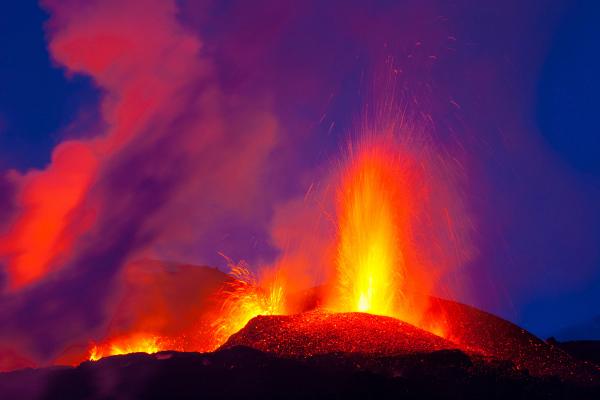
Reynisfjara Black Sand Beach
Iceland has a large number of black sand beaches, and Reynisfjara is the most popular. Near the town of Vík, this striking beach is framed by basalt columns and sea stacks. It’s a great place to take a walk and absorb the beauty, but be careful. The waves here are strong, known as “sneaker waves,” and they appear out of nowhere.
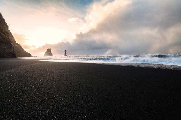
Dyrhólaey
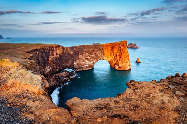
Close to Reynisfjara, Dyrhólaey is a promontory with a massive rock arch and coastal views. It’s a hotspot for birdwatching, especially in summer when puffins nest on the cliffs.
Where to Stay Near Gljúfrabúi
South Iceland boasts numerous campsites that cater well to campervan travelers, providing easy access to Gljúfrabúi and nearby attractions. These range from basic setups to spots with more amenities, all set against the region’s stunning backdrop.
Hvolsvöllur Camping Ground
Opening Period: May to October.
Distance to Gljúfrabúi: 22 kilometers (13.5 miles)
Located in the town of Hvolsvöllur, this campsite offers flat pitches with toilets, showers, electricity hookups, free Wi-Fi, a washing machine and dryer, and a playground for children. It’s quite close to the town’s center, with access to services such as a bank, post office, pharmacy, supermarket, restaurants, and a gas station.
Hellishólar
Opening Period: All year.
Distance to Gljúfrabúi: 25 kilometers (16 miles)
Hellishólar is a quite big camping ground with grassy pitches for campervans and tents, toilets, showers, a laundry room, electricity, and a playground for children. You’ll also find a restaurant on-site and a 9-hole golf course. There are also cottages for rent.
Skógar Camping Ground
Opening Period: All year.
Distance to Gljúfrabúi: 30 kilometers (19 miles).
Right by Skógafoss, this campsite offers simple pitches with electricity, restrooms, showers, and a small shop for basics. And, the best of it, the surroundings are impressive. It is possible to camp in tents, vans, or caravans all year round. Reservations are not required.
Gaddstaðaflatir Camping
Opening Period: May to September.
Distance to Gljúfrabúi: 34 kilometers (21 miles)
This camping ground is not far from the town of Hella. It has toilets, electricity, and a service building with cooking facilities and indoor dining space.
Laugaland
Opening Period: May to September.
Distance to Gljúfrabúi: 48 kilometers (30 miles).
This family-friendly campsite is one of the most comprehensive in South Iceland. The site is divided into two areas and has three playgrounds and a football field. The facilities include toilets, showers, electricity, BBQ area, and hot tubs.
The Weather at Gljúfrabúi
- Summer (June to August): Temperatures range from 10-15°C (50-59°F), with up to 20 hours of daylight, thanks to the Midnight Sun. The mild weather makes wading into the gorge comfortable, but rain and wind are common. South Iceland is one of the warmest areas in the country, but also one of the wettest and windiest. It’s peak season, so expect more visitors, especially at Seljalandsfoss nearby.
- Autumn (September and October): The temperature gradually decreases, ranging from 5-10°C (41-50°F). The days also shorten, but the landscapes turn vibrant with fall colors. Rainfall picks up, and winds can be strong— dressing in layers is key. There are not many tourists in this season.
- Winter (November to March): Expect temperatures ranging from 0-5°C (32-41°F) or colder, with snow covering the ground. The days are quite short, so you’ll have to plan your visit for a few hours with natural light. Be cautious when walking on paths, as they may be covered in ice. The waterfall looks really beautiful, but walking through the stream can be complicated. The roads in this area are usually open, but it's always best to check before traveling.
- Spring (April and May): Temperatures begin to rise again to 5-10°C (41-50°F). The melting snow causes the water flow to reach its optimal level, making the falls more dramatic. Weather shifts between sun, rain, and wind, so waterproof gear is essential. Trails can get muddy.
Travel Tips
- Pack waterproof boots and a jacket for the stream and the mist that comes off the waterfall.
- Visit early morning or late evening to avoid peak crowds, especially if you’re combining Gljúfrabúi with Seljalandsfoss.
- Fill up fuel in Hvolsvöllur or other towns. There are not many gas stations in rural areas.
- Stick to marked paths and take all trash with you to preserve the area.
- Check the weather forecast regularly. The conditions can change quickly and affect your travel plans.
- Plan a south coast loop to include Gljúfrabúi with other highlights like Skógafoss and Reynisfjara.
Conclusion
Gljúfrabúi is a simple but stunning stop that will make your trip to Iceland even better. It’s really close to one of the most famous natural monuments in South Iceland, and combining the two of them should be in every traveler’s list. It’s also quite close to several camping grounds where you can park your campervan for the night. Pack your gear, hit the Ring Road, and step into this hidden waterfall.

