Exploring Iceland's Glaciers: A Journey of Ice, Fire, and Adventure
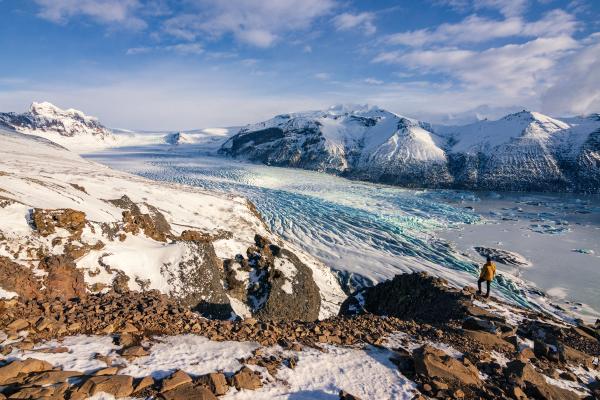
Iceland's glaciers are a key part of its landscape. These ice sheets cover about 10% of the island, creating a stunning backdrop. From easy-to-reach glacier tongues for first-time hikers to remote ice caps for adventurous travelers, these frozen giants offer unique experiences.
Here's what you need to know about Iceland's glaciers: how they formed, why they matter, which ones to visit, and ways to experience them. This guide gives you the complete picture, whether you're planning a trip or are just curious.
Key Takeaways
- Iceland has 269 named glaciers, with Vatnajökull being the largest in Europe
- Climate is causing glacial retreat; some may disappear within decades
- Glacier activities include hiking, ice cave exploration, snowmobiling, and lagoon tours
- Always visit glaciers with certified guides for safety reasons
- The best time for natural ice caves is winter (November-March)
- Most glacier areas can be reached on day trips from Reykjavík
How Iceland's Glaciers Formed
Iceland's glaciers began forming about 3.3 million years ago during the ice ages. Iceland was formed through a mix of volcanic activity and heavy snowfall.
When snow falls on Iceland's Highlands year after year and doesn't melt, it slowly compresses into ice. Iceland's glaciers are temperate (near 0°C throughout), unlike polar ice caps. This gives them a wet base that lets them slide more easily over the land, carving valleys and fjords.
The volcanic landscape underneath adds another element. Some eruptions happen beneath the ice, creating formations called hyaloclastite ridges when lava cools rapidly against the glacier. This mix of fire and ice has shaped Iceland's terrain for millions of years.
Today's glaciers are mostly remnants of much larger ice sheets that once covered the entire island. After the last ice age ended about 10,000 years ago, most of the ice melted. The glaciers we see now grew during cooler periods like the Little Ice Age (1300-1850) and reached their maximum size around 1890. Since then, they've been retreating, with higher temperatures accelerating the process in recent decades.
The Importance of Iceland’s Glaciers
These massive ice sheets aren't just nice to look at, they're important to Iceland in several ways:
Water Resources
Glaciers store a huge amount of freshwater: about 20 times Iceland's annual rainfall. They feed Iceland's major rivers, including Þjórsá (the country's longest), providing a steady water supply even during dry periods.
Clean Energy
The meltwater from glaciers powers Iceland's hydroelectric plants, which generate about 70% of the country's electricity. This renewable energy source has helped Iceland become a leader in clean power.
Climate Indicators
Scientists study Iceland's glaciers to track climate change. Their rapid retreat provides visible evidence of warming temperatures, making them indicators for global climate shifts.
Tourism Economy
Glacier tourism has become a major industry, attracting millions of visitors and generating billions of dollars in revenue for Iceland each year. From guided hikes to ice cave explorations, these frozen landscapes support jobs throughout the country.
Cultural Identity
Glaciers are deeply embedded in Icelandic culture and folklore. They appear in sagas, literature, and art, symbolizing the nation's connection to its landscape. The phrase "Land of Fire and Ice" shows how central glaciers are to Iceland's identity.
Iceland's Most Famous Glaciers
Let's look at the major glaciers you might want to visit, starting with the biggest:
Vatnajökull
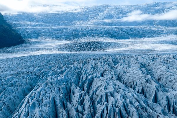
Vatnajökull covers southeastern Iceland, spanning about 7,600 square kilometers, roughly 8% of the entire country. It's not just big, it's also diverse:
- It contains Iceland's highest peak, Hvannadalshnjúkur (2,110 m)
- Seven active volcanoes hide beneath its ice
- Its thickness reaches up to 1,000 meters in places
- More than 30 glacier tongues flow from its edges
The most famous feature of Vatnajökull is Jökulsárlón Glacier Lagoon, where massive icebergs calve from the glacier and float in a deep blue lake before drifting out to sea. The nearby Diamond Beach gets its name from the ice chunks that wash up on black sand.
Vatnajökull National Park protects the glacier and the surrounding areas, forming Europe's largest national park. You can explore parts of the glacier through guided hikes at Skaftafell, boat tours at Jökulsárlón, or winter ice cave tours that take you inside the glacier itself.

Langjökull
Langjökull ("Long Glacier") is Iceland's second-largest glacier, spanning approximately 820 square kilometers. Its elongated shape stretches through the western Highlands, making it the closest major glacier to Reykjavík, just a 2-hour drive away.
What makes Langjökull special is its accessibility and unique attractions:
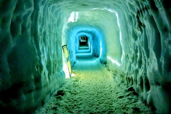
- It's home to "Into the Glacier," a man-made ice tunnel that lets you walk inside the glacier year-round
- The most popular spot for snowmobile tours
- Often included as an add-on to Golden Circle day trips
- Panoramic views of the Highlands
Unlike Vatnajökull's natural ice caves (which are only stable in winter), Langjökull's man-made tunnel is open all year. Inside, you can see the layers of ice, learn about glacial formation, and even visit a small chapel carved into the ice (a popular spot for weddings).
Mýrdalsjökull & Eyjafjallajökull
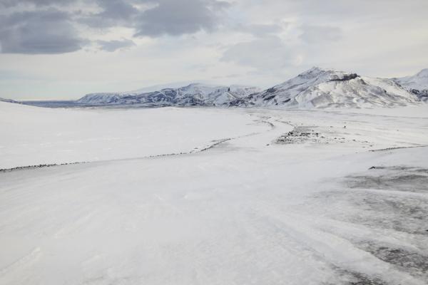
Mýrdalsjökull (about 510 square kilometers) covers the Katla volcano, one of Iceland's most active. Its most accessible tongue, Sólheimajökull, has become the go-to spot for glacier hiking due to its proximity to the Ring Road.
Eyjafjallajökull (about 66 square kilometers) became famous worldwide in 2010 when its volcanic eruption sent ash clouds across Europe, disrupting air travel for weeks. While smaller than its neighbors, its volcanic cone shape makes it very photogenic.
The area between these two glaciers features the popular Fimmvörðuháls hiking trail, which passes between the ice caps and offers views of both glaciers.

Other Notable Glaciers
- Hofsjökull (795 square kilometers): The third-largest glacier sits in the remote Central Highlands. Few tourists visit because it’s not really accessible, but it sources several major rivers.
- Drangajökull (136 square kilometers): The northernmost major glacier, located in the Westfjords. It's the only large glacier entirely below 1,000 meters in elevation and was historically the slowest to retreat due to heavy snowfall in the region.
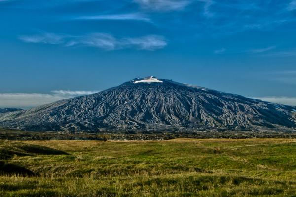
- Snæfellsjökull (11 square kilometers): Though small, this glacier-capped volcano on Snæfellsnes Peninsula is famous as the entry point in Jules Verne's "Journey to the Center of the Earth." Its distinctive peak is visible from Reykjavík on clear days.
How Glaciers Shape the Land
Glaciers reshape everything in their path. In Iceland, they've created some of the country's most striking landscapes:
Valleys and Fjords
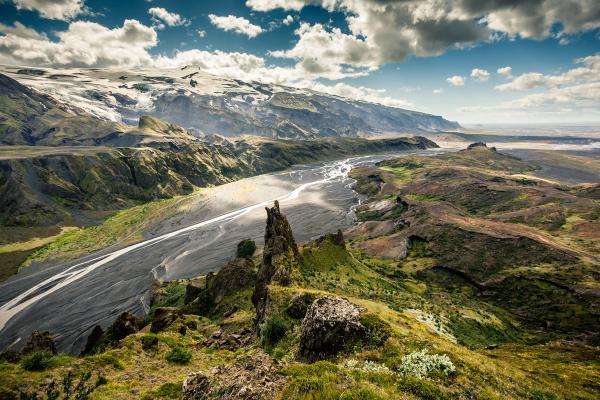
The weight of moving ice carves U-shaped valleys like Þórsmörk, near Eyjafjallajökull. The deep fjords of the Westfjords were also formed by ancient glaciers cutting into the coastline.
Lagoons and Lakes
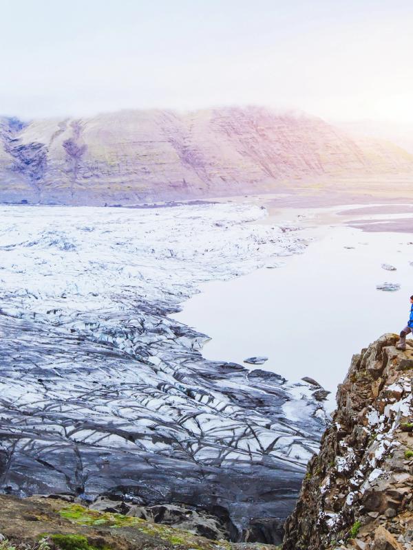
As glaciers retreat, they often leave depressions that fill with meltwater. Jökulsárlón is the most famous example, formed as Breiðamerkurjökull (an outlet of Vatnajökull) retreated from the coast.
Sandar (Outwash Plains)
South Iceland's vast black-sand plains were formed by glacial floods that deposited sediment. These flat expanses are often crossed by braided rivers carrying meltwater to the sea.
Jökulhlaups (Glacial Floods)
When volcanoes erupt beneath glaciers, they can melt enormous amounts of ice in minutes. This water builds up under the glacier until it bursts out in catastrophic floods called jökulhlaups. The 1996 Grímsvötn eruption under Vatnajökull triggered a flood that washed away bridges and roads along the south coast.
Can You Walk on a Glacier?
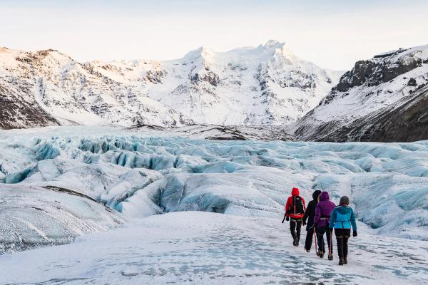
Yes, you can walk on Iceland's glaciers, but only with a certified guide. Glaciers are beautiful but dangerous places. Hidden crevasses, unstable ice formations, and sudden weather changes make glaciers risky; that’s why going on your own is dangerous.
Guided tours provide all the necessary safety equipment:
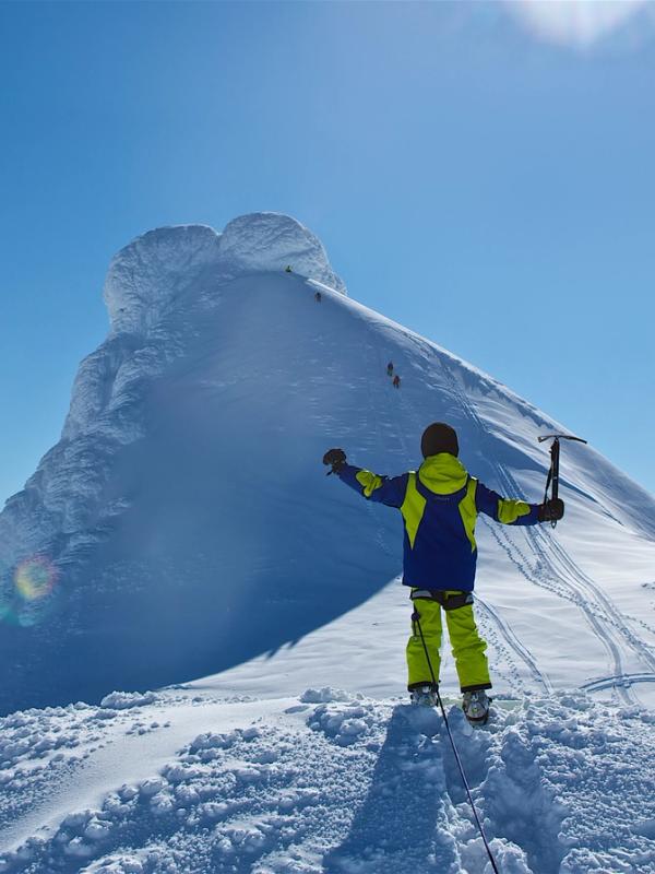
- Crampons for grip on the ice
- Helmets to protect from falling ice
- Ice axes for stability
- Harnesses and ropes for safety on steep sections
These tours also teach you how to move safely on the ice and explain the features you're seeing. Guides monitor conditions daily and know which areas are stable and which to avoid.
Even if a glacier looks solid and easy to walk on from a distance, the surface can hide deep cracks and unstable areas. Every year, tourists get injured trying to explore glaciers without the proper guidance.
Top Glacier Experiences
Iceland offers several ways to experience its glaciers up close. Here are the best options:
Glacier Hikes
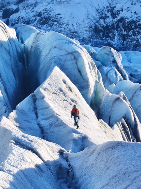
Stepping onto a glacier with crampons strapped to your boots is one of the best things you can do in Iceland. The ice crunches underfoot, sunlight sparkles on crystalline surfaces, and the vast expanse of white and blue stretches before you. Glacier hikes go from easy walks if you’re a beginner to challenging treks if you’re an experienced hiker.
- Sólheimajökull (Mýrdalsjökull): The most popular and accessible glacier hike, just 2.5 hours from Reykjavík. Tours range from easy 2-3 hour walks to more challenging ice climbing experiences. Costs start around $110.
- Skaftafell (Vatnajökull): Located in Vatnajökull National Park, these hikes offer views of Iceland's highest peak. Tours range from 3 to 5 hours and start at $115.
The best time for glacier hiking is from May to September, when the days are long and the weather is milder, although many operators run year-round.
Ice Caves
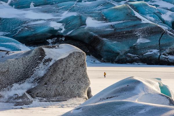
Entering an ice cave is like stepping into another world where walls, ceiling, and floor shimmer with a blue glow. These natural formations happen when meltwater carves tunnels through the glacier, which then freeze again in winter. The compression of the ice forces out air bubbles, creating the blue color that seems to come from within.
- Crystal Ice Cave (Vatnajökull): These natural blue ice caves form each winter inside Vatnajökull's outlet glaciers. Tours typically run from November to March and cost $180-200. Each winter creates different caves, so the experience changes year to year.
- Katla Ice Cave (Mýrdalsjökull): Unlike most natural ice caves, the Katla Ice Cave can be visited year-round due to its formation in ash-insulated ice. Tours depart from Vík and cost approximately $150-$200.
- Langjökull Ice Tunnel: This man-made tunnel lets you walk inside the glacier any time of year. Tours often combine it with snowmobiling and cost around $200 from Reykjavík (pickup and drop-off optional).
Snowmobiling
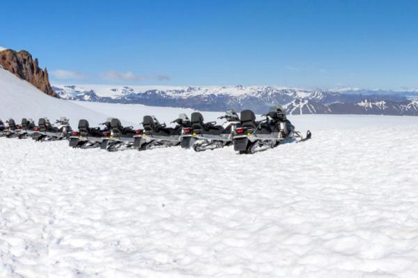
If you’re seeking a faster way to explore glaciers, snowmobiling lets you cover vast snowfields quickly. Traveling across the white expanse with mountains on the horizon gives you a sense of freedom and lets you see more of the glacier than you could on foot.
- Langjökull: The most popular spot for snowmobiling due to its proximity to Reykjavík and relatively flat terrain. One-hour tours cost approximately $280 and are often combined with the Golden Circle route.
- Vatnajökull: For more adventurous travelers, snowmobiling on Europe's largest glacier offers views and a sense of wilderness. Tours from the south coast cost $250 and last 3 hours.
Boat Tours Among Icebergs
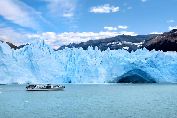
Cruising among floating icebergs gives you a unique view of glaciers. These massive chunks of ancient ice, calved directly from the glacier face, drift slowly through lagoons. The contrast of blue ice against dark water makes for good photos and lasting memories.
- Jökulsárlón Glacier Lagoon: Amphibious boat tours (about $50) or zodiac boat tours (about $130) take you up close to floating icebergs in this lagoon. Tours run from April to October.
- Fjallsárlón: A smaller, less crowded glacier lagoon near Jökulsárlón with similar boat tours at slightly lower prices.
When to Visit
The best time to visit Iceland's glaciers depends on what you want to experience:
Summer (June-August)
- Advantages: Long daylight hours (up to 24 hours in June), warmer temperatures, easier access to highland areas
- Best for: Glacier hiking, snowmobiling, lagoon boat tours
- Drawbacks: Peak tourist season means the glaciers are more crowded and the prices are higher; fewer natural ice caves
Winter (November-March)
- Advantages: Natural ice caves are accessible, and the Northern Lights might appear during tours
- Best for: Ice cave exploration, photography, snowmobiling
- Drawbacks: Short daylight hours (4-6 hours in December), colder weather, some highland roads closed
Shoulder Seasons (April-May, September-October)
- Advantages: Fewer crowds, moderate weather, lower prices
- Best for: Glacier hiking, photography
- Drawbacks: Unpredictable weather; ice caves may not be stable
For the best combination of experiences, early March offers both access to ice caves and increasing daylight hours. September delivers reasonable weather and fewer crowds after the summer rush.
Culture and Folklore of Iceland’s Glaciers
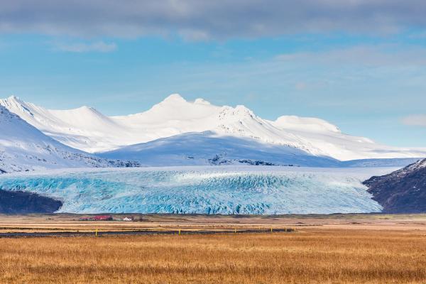
Glaciers hold a special place in Icelandic culture and imagination. For centuries, these remote ice caps were believed to be home to supernatural beings.
Snæfellsjökull is particularly rich in folklore. Local legends tell of elves and hidden people living within the glacier. Its mystical reputation was cemented in Jules Verne's 1864 novel "Journey to the Center of the Earth," which used the glacier as the entrance to an underground world.
Glaciers also appear in medieval Icelandic sagas, often as challenging landscapes where outlaws hid or heroes faced trials. The Bárðar saga describes the hero Bárður, who becomes a guardian spirit of Snæfellsjökull after disappearing into the glacier.
Looking Ahead: The Future of Iceland's Glaciers
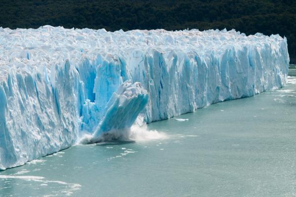
Iceland's glaciers are retreating at an alarming rate. Studies show they're losing approximately 8.3 billion tons of ice annually, with overall volume projected to decrease by up to one-third by 2100.
The most visible changes are at glacier edges, where tongues that once extended down to the lowlands are rapidly pulling back up mountain slopes. Smaller glaciers, such as Snæfellsjökull, have lost most of their ice; its summit was ice-free for the first time in recorded history in 2012.
This retreat has several implications:
- "Peak water": Ironically, the melting of glaciers initially increases water flow to rivers and hydropower plants, but once the glaciers shrink significantly, river flow will decrease, affecting energy production and ecosystems.
- Changing landscapes: New lakes form as ice retreats, while land rises due to the reduced weight of ice (up to 35mm per year in some places).
- Tourism adaptation: Tour operations constantly adjust routes as glacier edges retreat and new hazards emerge.
The Icelandic Meteorological Office closely monitors all major glaciers, producing annual reports on their status. Scientists also use satellite imagery to track changes across all of Iceland's ice caps.
Conclusion
Iceland's glaciers offer some of the most accessible and spectacular ice experiences on the planet, and there's an experience for everyone.
If you visit Iceland, take the time to include at least one glacier experience in your itinerary. Just remember to go with certified guides, dress in layers, and bring your sense of wonder. The ice is waiting.


