Guide to Ásbyrgi Canyon in Iceland: A Mythologic Wonder
Ásbyrgi Canyon in northeast Iceland stands out from the landscape around it. This horseshoe-shaped depression with 100-meter cliffs offers so many experiences, from forest walks to viewpoints where you can see the entire horseshoe shape, and it’s rich in history and folklore.
If you’re roaming around North Iceland looking for a spot to wow you, Ásbyrgi may be the place.
Key takeaways
- Ásbyrgi is a horseshoe-shaped canyon in northeast Iceland, part of Vatnajökull National Park and a stop on the Diamond Circle route
- The canyon was formed by major floods around 8,000-10,000 years ago
- According to Norse mythology, the canyon was created by the hoofprint of Sleipnir, Odin's eight-legged horse
- Best visited June-September when facilities are open and trails clear
- Has hiking trails for all fitness levels, from easy walks to longer rim trails
- Nearby attractions include Dettifoss waterfall, Hljóðaklettar (Echo Rocks), and Húsavík for whale watching
What's Ásbyrgi Canyon?
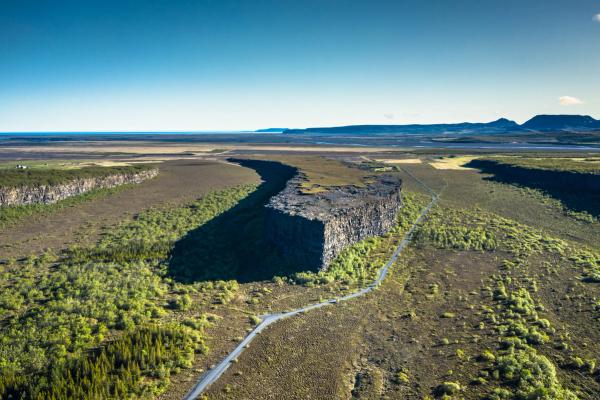
Ásbyrgi (pronounced "AUS-bir-gee") is a horseshoe-shaped canyon in northeast Iceland, about 62 km (38.5 miles) from Húsavík. The name means "Shelter of the Gods" in Icelandic, which fits its unusual appearance.
The canyon is approximately 3.5 kilometers (2.2 miles) long and 1.1 kilometers (0.7 miles) wide, with cliff walls reaching heights of up to 100 meters (328 feet). What makes Ásbyrgi special is its horseshoe shape and the forest that grows on its floor, something unusual in Iceland, where trees cover only 1-2% of the land.
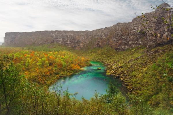
In the middle of the canyon stands Eyjan ("The Island"), a rock formation that rises 25 meters (82 feet) above the canyon floor and splits the horseshoe for about half its length. At the southern end is Botnstjörn, a small pond surrounded by birch trees and cliffs, making it a good spot to relax and watch birds.
Ásbyrgi is part of the Jökulsárgljúfur canyon region within Vatnajökull National Park and is on the Diamond Circle, a driving route in North Iceland that also includes Dettifoss waterfall, Lake Mývatn, and Húsavík.
Formation, Geology & Folklore
Ásbyrgi wasn't created by a river like many canyons. It was shaped by massive floods (jökulhlaups) that happened when volcanic eruptions under the Vatnajökull glacier suddenly melted huge amounts of ice.
Scientists think at least two major flood events shaped Ásbyrgi; one around 8,000-10,000 years ago as the Ice Age ended, and another about 3,000 years ago. These floods carried massive amounts of water and debris down the Jökulsá á Fjöllum river, carving out the canyon's horseshoe shape. Today, the river flows about 2 kilometers east of the canyon, having changed course since these ancient floods.
The canyon walls are made of layers of basalt from old lava flows, with the central Eyjan formation left standing as the floods washed away softer materials around it.
The Legend of Sleipnir's Hoofprint
While scientists explain Ásbyrgi through floods, Icelandic folklore tells a different story. According to Norse mythology, the canyon was formed when Sleipnir, the eight-legged horse of Odin (the main Norse god), touched down briefly on Earth during one of Odin's journeys. The massive horseshoe shape is said to be Sleipnir's hoofprint left in the landscape. The name "Shelter of the Gods" comes from this connection.
The Home of Hidden Folk
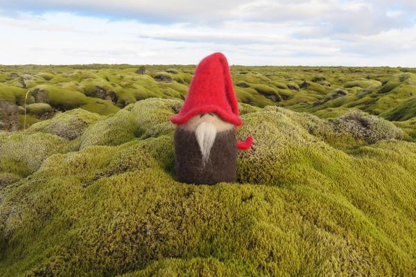
Ásbyrgi is also linked to Icelandic beliefs about huldufólk (hidden people or elves). Local stories say that Ásbyrgi's cliffs and wooded areas are home to these beings. Some Icelanders believe the canyon, especially around Botnstjörn pond, is a gathering place for the hidden folk.
You probably won't see any elves during your visit, but the stories add to the canyon's atmosphere and show Iceland's cultural connection to its landscape.
Location & How to Get to Ásbyrgi
Ásbyrgi Canyon is in northeast Iceland, about 525 km (7-hour drive) from Reykjavík, 150 km (2-hour drive) east of Akureyri, and 62 km (45-minute drive) east of Húsavík.
By Car
The easiest way to reach Ásbyrgi is by car. From Reykjavík or Akureyri (coming from the west), follow the Ring Road (Route 1) toward Húsavík. Then, take Route 85 east through Húsavík and along the Tjörnes Peninsula. Turn onto Route 862 when you see signs for Ásbyrgi or Vatnajökull National Park. The road leads straight to the canyon's entrance and parking lot.
If you’re coming from the east (after visiting Dettifoss), take Route 864 or 862 north through Jökulsárgljúfur canyon. Both roads connect near Ásbyrgi. Note that Road 864 is a gravel road and can be rough (4x4 recommended), while Road 862 is partly paved. Always check road conditions at road.is before traveling, especially outside the summer months.
By Tour
Several tour companies offer day trips to Ásbyrgi as part of Diamond Circle tours, leaving from Akureyri or Húsavík. These typically include transportation and visits to other attractions like Dettifoss and Húsavík for whale watching. Costs range from 25,000-40,000 ISK (~$205-$330) per person.
Public Transport
Public transportation options are limited. In summer, occasional buses run from Akureyri to the region, but schedules are infrequent. For most visitors, self-driving or joining a tour is the best option, unless you’re traveling on a very tight budget and don’t mind “wasting” some time.
Once at Ásbyrgi, there's parking near the visitor center and campground, with easy access to the canyon's main features.

Things to Do There
Ásbyrgi offers activities for nature lovers, photographers, and anyone interested in Iceland's landscape and folklore.
Hiking
Ásbyrgi has a network of marked trails that show off the canyon's diverse landscapes, from forests to cliffs. Maps are available at the visitor center, and summer (June-August) offers the best conditions with long daylight hours for hiking.
Canyon Floor Trail
This easy path goes through birch woodland to Botnstjörn pond. It’s good for casual walkers and those with limited mobility.
- Length: 2 km round trip
- Time: 30-45 minutes
- Difficulty: Easy
- Accessibility: Partly wheelchair-accessible with flat terrain
- Highlights: Woodland birds, pond views, seasonal flowers
- Starting point: Main parking area near visitor center
Eyjan Summit Trail
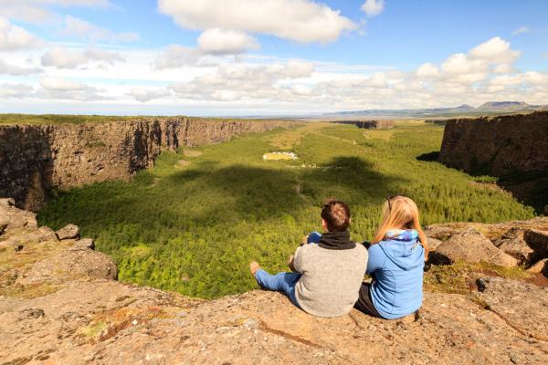
Climb to the top of the "Island" for a panoramic view of the horseshoe canyon; a must for photographers and first-time visitors.
- Length: 3 km round trip
- Time: 1-1.5 hours
- Difficulty: Moderate
- Elevation gain: 25 meters
- Highlights: 360-degree views of the canyon, cliff perspectives
- Caution: No guardrails at cliff edges
- Best time: Sunrise or sunset for good lighting
- Starting point: Campground area
Canyon Loop Trail
This longer hike follows the canyon's upper edges, offering wide views of the entire formation.
- Length: 12.7 km loop
- Time: 3-4 hours
- Difficulty: Moderate
- Elevation gain: 290 meters
- Highlights: Views of cliffs, Eyjan, and the river valley
- Terrain: Some rocky sections and moderate climbs
- Preparation: Bring water and snacks as there are no facilities on the trail
- Starting point: Visitor center parking lot
Tófugjá Trail
This less-known path explores the northern rim with signs about local legends.
- Length: 4 km round trip
- Time: 1.5-2 hours
- Difficulty: Moderate
- Highlights: Views of the canyon's full horseshoe shape, folklore information
- Terrain: Gentle slopes and some rocky areas
- Starting point: Northern parking area
Klappir Trail
Connect to nearby Hljóðaklettar (Echo Rocks) via this path through unusual basalt formations.
- Length: 8 km one way
- Time: 2.5-3 hours
- Difficulty: Moderate
- Highlights: Basalt columns, acoustic effects, flood-shaped landscape
- Terrain: Uneven with moderate elevation changes
- Planning note: Consider transportation for the return trip
- Starting point: Southern end of Ásbyrgi
Botnstjörn Loop
Circle the pond at the canyon's southern end for wildlife watching and forest walks.
- Length: 5 km loop
- Time: 1.5-2 hours
- Difficulty: Easy to moderate
- Highlights: Pond reflections, waterfowl, quiet forest areas
- Terrain: Mostly flat with some uneven paths
- Best for: Birdwatching and photography
- Starting point: Botnstjörn trailhead near the visitor center
Birdwatching
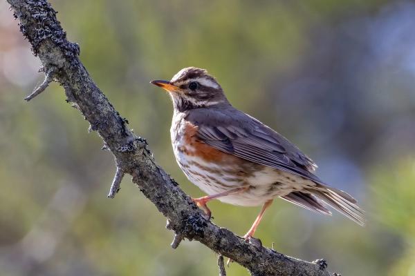
The canyon's various habitats attract different bird species. Around Botnstjörn pond, you might see redwings, snipes, and waterfowl, while the woodland has ptarmigan and small songbirds. The cliffs are home to ravens and sometimes falcons. Bring binoculars and visit in the early morning or evening for the best birdwatching, especially in spring and summer.
Photography
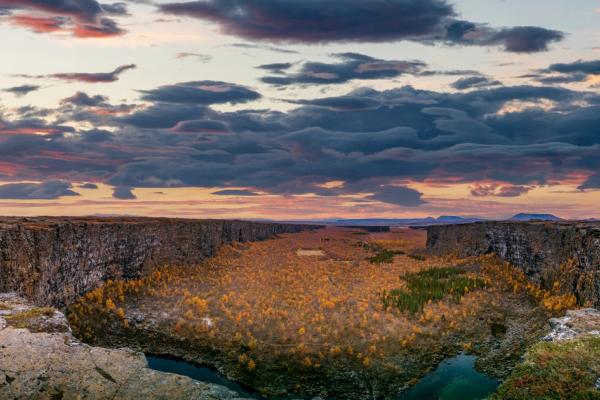
Ásbyrgi offers many photography opportunities. The Eyjan Summit and Tófugjá viewpoint provide wide views of the canyon's horseshoe shape, while the Botnstjörn pond reflects the cliffs on calm days. The birch forest stands out against the stark cliffs, especially during the hour after sunrise or before sunset when the light creates shadows across the landscape. Visit in September or October for the autumn colors that add reds and yellows.

Camping
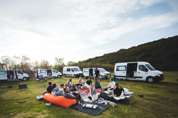
The on-site campground (open from June to September) offers tent and caravan sites with facilities including showers, laundry, and electricity (for a fee). Camping under the midnight sun in summer or beneath stars in early autumn gives you a unique experience within the canyon. The closeness to hiking trails lets you explore in the early morning or late evening when the light is best.
Cultural Exploration
Learn about Ásbyrgi's mythology and geology at the Gljúfrastofa Visitor Centre, which has exhibits on the canyon's formation and local folklore. Just by walking, you can see the signs explaining the Sleipnir legend and geology. In summer, occasional storytelling sessions focus on Norse myths and huldufólk legends.
Practical Tips for Visitors
Knowing about Iceland's weather patterns and the best times to visit can make your trip much better.
Weather
Iceland's weather changes often. At Ásbyrgi, (June-August) daytime temperatures during summer are usually 10-15°C (50-59°F), while spring and fall are cooler (5-10°C/41-50°F) with more changeable conditions. Winter can drop below freezing, with snow and limited daylight. Always pack layers, waterproof clothing, and sturdy footwear, no matter when you visit.
Best Time to Visit
Peak season (June-August) offers 24-hour daylight thanks to the Midnight Sun, fully working facilities, clear and accessible trails, warmer temperatures, but more tourists. The Shoulder season (May, September-October) brings fewer crowds, decent weather, and autumn colors in September-October, though some facilities may have shorter hours. Seeing the Northern Lights may be possible from late August if you’re really lucky.
Winter (November-April) comes with challenges: very limited daylight, snow-covered landscapes, closed facilities, and difficult road conditions, though crowds are at their lowest. For most visitors, June-September offers the best balance of good weather, accessibility, and open facilities.
What to bring
- Waterproof jacket and pants (Iceland's weather changes quickly)
- Sturdy hiking boots with good ankle support
- Layered clothing (thermal base layers, mid-layers, and outer shell)
- Hat, gloves, and warm socks (even in summer)
- Sunglasses and sunscreen (summer sun can be strong, especially with reflections)
- Water bottle and snacks
- Camera with extra batteries
- Binoculars for birdwatching
- Map or offline GPS app
- Icelandic phrase book (though English is widely spoken)
Traveling tips
- Check road.is before traveling, especially in spring, fall, and winter
- Fill up on fuel in Húsavík or larger towns before heading to Ásbyrgi
- Download offline maps, as cell coverage can be spotty
- Bring food, water, and snacks, as dining options are limited
- Stay on marked trails and be careful near cliff edges (no railings in many areas)
- Follow Leave No Trace principles and respect local beliefs
- Start hikes early in peak season to avoid crowds
- Allow extra time for driving, as you'll want to stop for photos
Where to Stay: Campsites near Ásbyrgi Canyon
Sleeping close or even inside the Ásbyrgi Canyon is a really good idea if you want to take full advantage of your visit. You’ll be able to experience it without the crowds and have more time to complete as many hikes as you want.
Ásbyrgi Campground
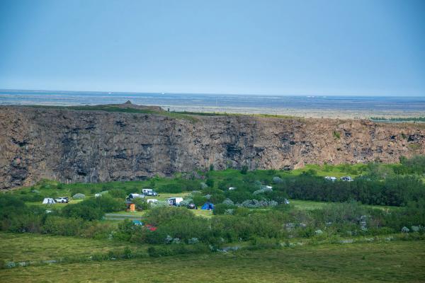
Located right at the canyon entrance next to the visitor center, the Ásbyrgi Campground has space for tents and vehicles, electrical hookups, showers, toilets, laundry, and drinking water. It's open from June to late October and costs about 2,800 (~$20) per person per night, with electrical hookups for an extra fee. You can reserve through the Parka app (tjalda.is) or on-site. This is the most convenient option.
Vesturdalur Campground
For a more basic experience, try Vesturdalur Campground, 20 km south in Jökulsárgljúfur canyon near Hljóðaklettar. This campsite is tent only, and doesn’t offer hot water or electricity. It opens June-September, with costs around 2,000-2,500 ISK (~$15-18) per person, this first-come, first-served site works well for those planning to hike between Ásbyrgi and Dettifoss.
Húsavík Campsite
In Húsavík town, 62 km (38.5 miles) west of Ásbyrgi, there's a campsite with full services including hookups, kitchen, and hot showers. It opens year-round, offering full services in summer. It costs 2,000 ISK (~$ 16.50) per person. You can book via husavik.is or on-site. This option has more facilities and is close to restaurants and shops in town.
Indoor Accommodation
If camping isn't for you, consider Ásbyrgi Cottages & Guesthouse near the canyon. Availability is limited, so book well ahead. Other options include guesthouses and hotels in Húsavík or accommodation in the Mývatn area (90 km south), which offers many options near the lake and geothermal areas.
Things to Do & Places to Visit near Ásbyrgi Canyon
Ásbyrgi is part of Iceland's Diamond Circle route, so you can visit 4-5 amazing spots in just one day easily.
Dettifoss Waterfall
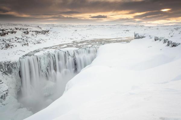
Located 36 km (22 miles) south of Ásbyrgi, Dettifoss is Europe's second most powerful waterfall by volume. It's 44 meters high and 100 meters wide, and accessible via Route 862 (west side, better facilities) or 864 (east side, more rugged). From there, you can hike to the other two stunning waterfalls, Selfoss upstream and Hafragilsfoss downstream. Allow 1-2 hours for the visit, including walking to viewpoints.
Hljóðaklettar (Echo Rocks)
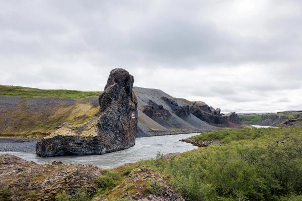
Just 18 km (11 miles) south of Ásbyrgi, Hljóðaklettar has unusual basalt formations with strange acoustic properties. These columns, caves, and arches were shaped by ancient floods and create interesting sound reflections (hence the name "Echo Rocks"). Several hiking trails ranging from 1-3 hours allow you to explore these geological features.
Húsavík
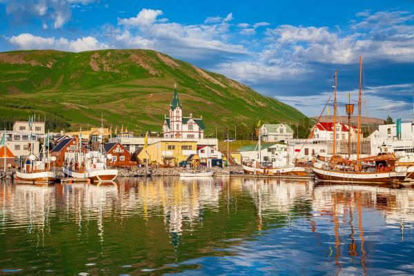
Known as Iceland's whale-watching capital, Húsavík is 62 km (38.5 miles) west of Ásbyrgi. The town has a high success rate for spotting humpbacks, minkes, and sometimes blue whales. You can visit the Húsavík Whale Museum to learn about cetacean life, or explore the traditional wooden church and the harbor area for some culture. With restaurants and services available, it's an excellent stop for supplies, too. Whale-watching tours last about 3 hours and cost around 10,000-15,000 ISK (~$75-110).
Lake Mývatn
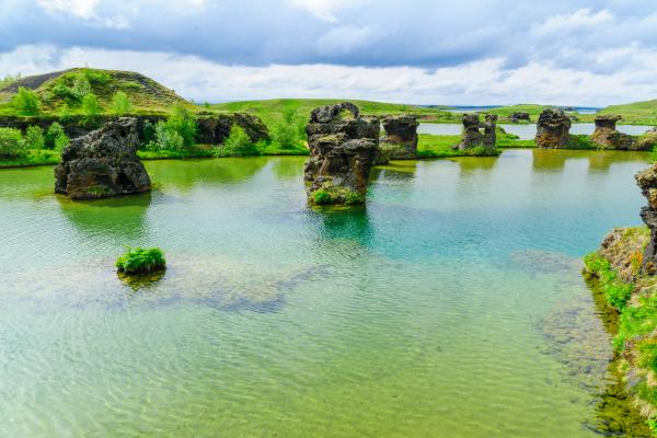
About 80 km south of Ásbyrgi, Lake Mývatn offers geothermal features including Námaskarð mud pots and steam vents, Dimmuborgir lava formations ("Dark Castles"), and the Mývatn Nature Baths (a less expensive alternative to the Blue Lagoon). The area is known for its rich birdlife, especially waterfowl, and the pseudocraters at Skútustaðir show Iceland's volcanic activity. This region is worth a full day of exploration, so don’t rush it if you have the time.
Tjörnes Peninsula
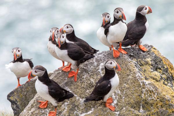
Between Húsavík and Ásbyrgi, the Tjörnes Peninsula features fossil-rich sea cliffs (some 15 million years old), coastal viewpoints, and the chance to spot puffins in summer (May-August). If you don’t have a lot of time, just do a detour while you drive between Húsavík and Akureyri. The coastal road provides views of the Arctic Ocean.
The Arctic Henge
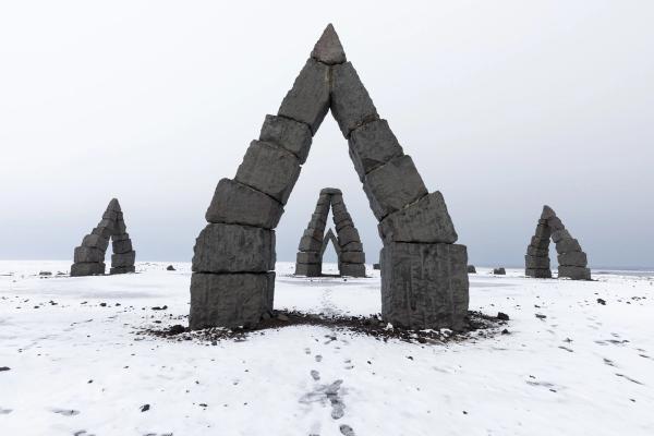
In Raufarhöfn, 50 km northeast of Ásbyrgi, is the Arctic Henge, a modern monument inspired by Norse mythology. This stone circle with arches aligned with the Midnight Sun is a great stop for those interested in modern interpretations of Norse heritage and those seeking to understand how myths continue to inspire Icelandic culture nowadays.
Conclusion
Ásbyrgi Canyon combines dramatic geology with rich mythology in a unique horseshoe-shaped wonder. With its towering cliffs, rare woodland, and variety of trails, it offers an exceptional North Iceland experience.

