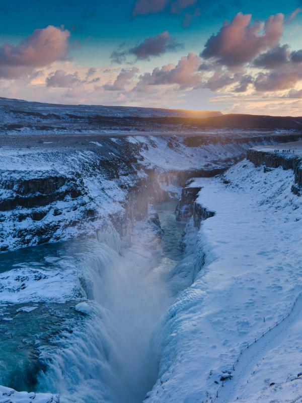
Iceland's Canyons: Where Fire and Ice Shape Stunning Landscapes
Iceland's canyons rank among the most striking geological features in the world. These deep gorges tell the story of an island formed by volcanoes, glaciers, and flowing rivers.
I explored several of these formations during my travels, and each has its own character: from basalt columns that look hand-crafted, to green moss-covered walls, to blue waters cutting through dark rock.
Key takeaways
- Iceland's canyons formed through glacial floods, volcanic activity, and river erosion
- Summer (June-September) offers the best access when roads are open and the weather is milder.
- Each canyon has distinct features - Ásbyrgi's horseshoe shape, Stuðlagil's hexagonal basalt column.s
- Many canyons connect to Norse mythology, with Ásbyrgi linked to Odin's eight-legged horse.
- Pack waterproof hiking boots, layers, and camera equipment for changing conditions.
What's a Canyon?
Canyons are deep, narrow valleys with steep sides, typically carved by rivers over long periods. Iceland's canyons stand out because some formed quickly, not over millions of years like the Grand Canyon, but sometimes in days or weeks through massive floods.
How Canyons in Iceland Formed
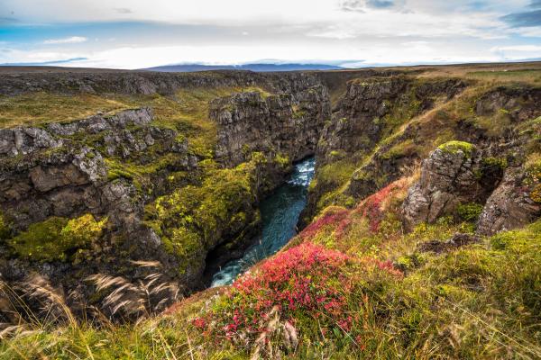
Iceland sits on the Mid-Atlantic Ridge, where two tectonic plates pull apart. This creates ideal conditions for canyon formation through three main processes:
- Glacial floods (jökulhlaups): When volcanoes erupt under glaciers, they cause massive floods that can carve canyons in days. Ásbyrgi Canyon formed this way about 8,000-10,000 years ago when floodwater from the Vatnajökull glacier rushed northward.
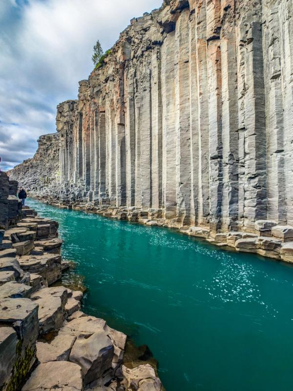
- Volcanic activity: Lava flows create the rock layers that rivers later cut through. The hexagonal basalt columns at places like Stuðlagil formed when lava cooled slowly and cracked in geometric patterns.
- River erosion: Over thousands of years, rivers like Jökulsá á Fjöllum deepen their channels through the volcanic landscape, especially when carrying glacial sediment.
This process has accelerated in the last decade, as melting glaciers increase water flow and flood frequency.
What Makes Iceland's Canyons Unique
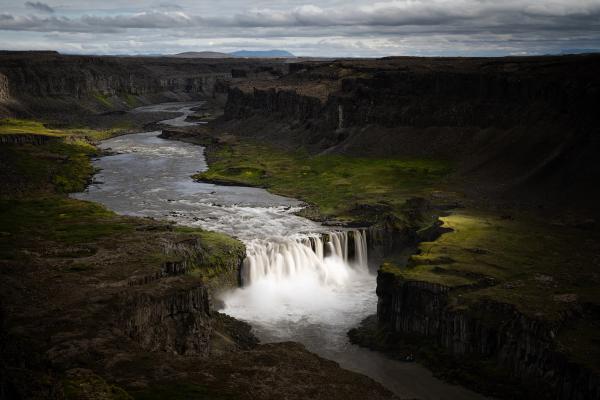
Unlike the ancient Grand Canyon, formed over millions of years, Iceland's canyons show young volcanic terrain. Many were carved less than 10,000 years ago through massive glacial floods called jökulhlaups. These floods, triggered when volcanoes erupted beneath ice caps, carved features like Ásbyrgi Canyon in days or weeks rather than over millennia. This quick formation gives Icelandic canyons sharper features and more dramatic shapes than those shaped by slow erosion.
The most eye-catching elements are the hexagonal basalt columns found in canyons like Stuðlagil. These perfect hexagons, sometimes stacked hundreds of feet high, formed when thick lava flows cooled slowly, causing the rock to contract and crack in regular patterns. This geological feature exists because Iceland sits directly on the Mid-Atlantic Ridge, where tectonic plates pull apart, creating a hotspot with over 30 active volcanic systems that constantly reshape the landscape.
Iceland's canyons also show a color mix not seen in drier canyon regions. Green moss grows on black basalt, while many canyons contain blue-white rivers colored by glacial silt. This mix of black rock, green moss, and blue water creates scenes that look almost made on purpose. These active geological sites continue to change today through ongoing volcanic activity, glacial retreat, and river flow, giving you a glimpse of Earth's forming processes in action.
Iconic Icelandic Canyons to Know
While Iceland has dozens of canyons, these five showcase the variety of landscapes across the island. Some are easy to reach and some others require longer hikes, but each offers its own rewards and character.
Fjaðrárgljúfur (South)
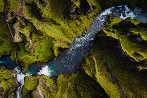
This 100-meter-deep (328-foot-deep), 2-kilometer-long (1.25-mile-long) canyon gained fame after appearing in Justin Bieber's "I'll Show You" music video in 2015. Located near Kirkjubæjarklaustur in South Iceland, it features winding green walls and a curving river below.
The canyon formed about 9,000 years ago during the post-Ice Age thaw when a glacial lake broke through and cut into the soft bedrock.
You can walk on a maintained trail with viewing platforms that runs along the canyon's edge. The trail is almost completely flat, so it’s suitable for all kinds of fitness levels. The trail diverts to viewpoints from where you can see the bottom of the canyon every 100-200 meters.
The canyon walls support Arctic thyme and moss species that take decades to grow, and sometimes you may see ravens soaring along the cliff edges.
The rise in tourism after Bieber's video led to temporary closures to protect the fragile moss. Today, all that is asked of you is to stay on marked paths.
Ásbyrgi (North)
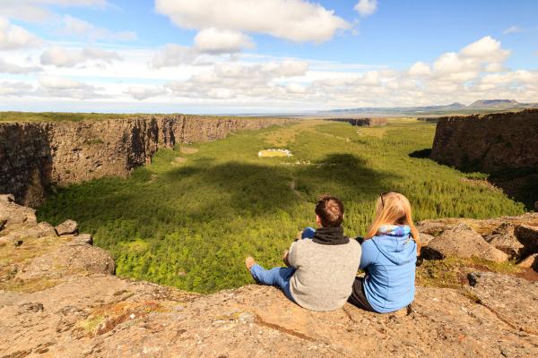
This large horseshoe-shaped canyon in Northeast Iceland spans 3.5 km (2.17 miles) in length and 1 km (0.62 miles) in width, with 100-meter (328-foot) cliffs surrounding a forested floor. The forest feature is pretty unusual in Iceland, where only 2% of the landscape is covered by trees.
Ásbyrgi is part of Vatnajökull National Park and offers several hiking trails. You can take easy walks around Botnstjörn pond or try the more challenging Eyjan viewpoint trail, which climbs the central "island" hill for expansive views.
According to Norse legend, Ásbyrgi formed when Sleipnir, Odin's eight-legged horse, touched one hoof to Earth. Locals also believed it housed hidden folk (huldufólk) and elves.
The sheltered canyon creates a unique microclimate that supports a birch forest, wildflowers, and a variety of bird species, including Arctic terns. You'll notice the contrast between the forest floor and the barren highlands above.
You can access it via Route 85, and it is located approximately 60 km (37 miles) east of Húsavík. The visitor center provides maps and information from mid-May through September. Facilities include toilets, a campground, and picnic areas.
Stuðlagil (East)
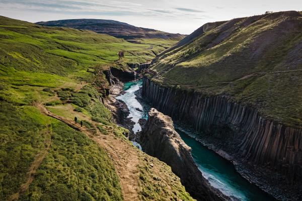
Perhaps Iceland's most photogenic canyon, Stuðlagil, stayed hidden until recently. When the Kárahnjúkar dam was built in 2009, water levels in the Jökulsá á Dal river dropped, revealing an impressive array of hexagonal basalt columns lining a narrow gorge with milky-blue glacial water.
This geological feature became popular on social media around 2016, and now attracts photographers seeking the classic shot of blue water flowing between geometric rock formations.
Located in East Iceland, about 70 km south of Egilsstaðir. From the Ring Road, turn onto Route 923 (Jökuldalsvegur). For the best views, take the east side approach: cross the bridge and follow signs to the parking area, then hike about 2 km to the canyon. The west side offers a viewing platform accessible via a staircase, although the views are limited.

Múlagljúfur (Southeast)
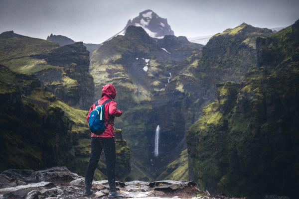
This hidden gem near Skaftafell rewards your hiking efforts with two stunning waterfalls, Hangandifoss and Múlafoss, set against dramatic cliff walls with glaciers visible in the distance.
The 4-6 km moderate hike (round trip) climbs steadily along the canyon rim, offering increasingly impressive views. The final overlook, where both waterfalls appear against the backdrop of green-tinged cliffs, resembles a prehistoric landscape.
Local folklore mentions guardian spirits (vættir) living in the canyon's depths and considers it a home for trolls and elves.
The canyon is also a great hotspot for wildlife. You might spot Arctic foxes in the early morning or late evening, and the area is home to ground-nesting birds in the spring.
Múlagljúfur is found about 15 km west of Jökulsárlón Glacier Lagoon. The road that leads to the canyon is unpaved, so it may be easy to miss. If you’re coming from Reykjavik, you’ll see the road on your left. If you’re using a GPS, enter these coordinates to make sure you don’t miss the turn: 63.9886667, -16.3971589. A 4x4 is recommended, especially after rain. There are no facilities at the trailhead.
Markarfljótsgljúfur & Hafrahvammagljúfur
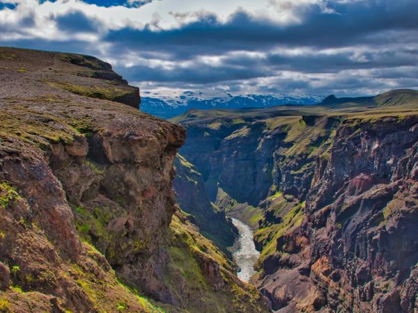
These two canyons rank among Iceland's deepest and most impressive, yet very few people know about them and visit them due to their remote locations.
- Markarfljótsgljúfur cuts through the highlands near Þórsmörk, with walls up to 200 meters deep and colorful rhyolite rocks. You can see the Markarfljót river flowing through its bottom from several viewpoints.
You can access Markarfljótsgljúfur via F-roads from Þórsmörk or some Highland routes.
- Hafrahvammagljúfur in East Iceland reaches 200 meters deep and 8 km long. Roads built for the Kárahnjúkar hydroelectric project now lead close to viewpoints where you can look over this massive gorge.
Hafrahvammagljúfur is accessible via the roads near the Kárahnjúkar dam.
Both require 4x4 vehicles and are only accessible in the Summer, as all the F-roads leading to the Highlands are closed the rest of the year.
Off-the-Beaten-Path Canyons
For a quieter experience away from popular spots, you can explore several lesser-known canyons that provide equally impressive experiences. These hidden locations require more effort to reach, but they reward you with untouched landscapes and a true sense of adventure.
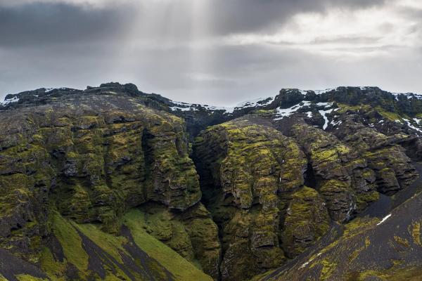
Rauðfeldsgjá
This narrow crack in the mountain on the Snæfellsnes Peninsula isn't a typical canyon, but a vertical fissure that you can hike into. The further you go, the narrower it gets, with only a small strip of sky visible above.
It was named after the Saga of Bárður Snæfellsás, where a man named Rauðfeldur was thrown into the gorge as punishment. You can access it via a short hike from the road near Arnarstapi.
Sigöldugljúfur (Valley of Tears)
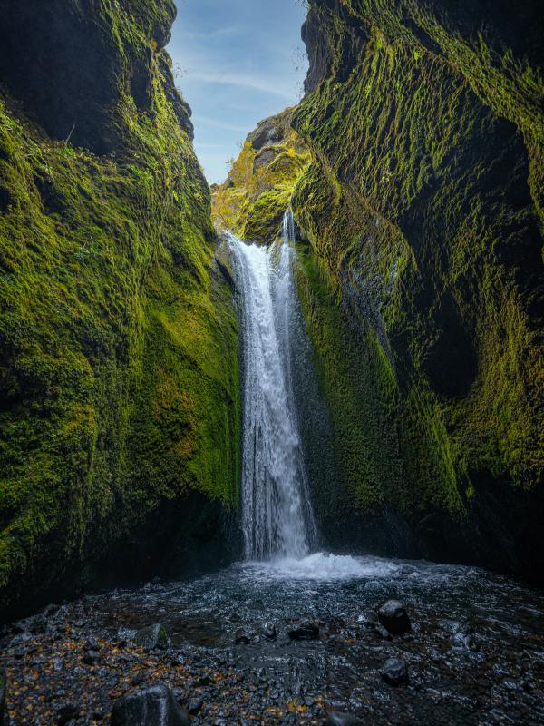
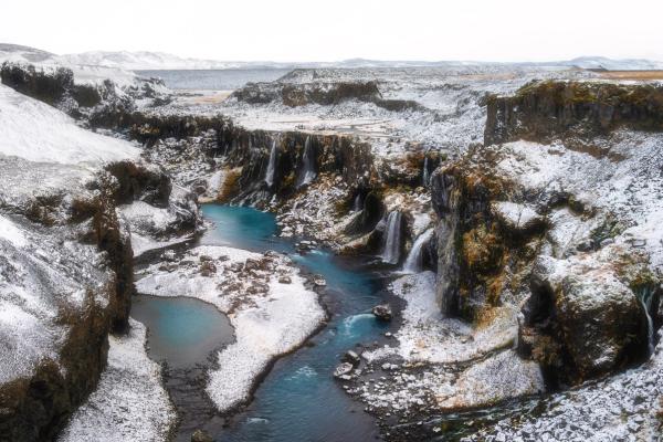
This hidden gem in the Highlands earned the name "Valley of Tears" for its multiple small waterfalls streaming down moss-covered canyon walls. The contrast between black rock, green moss, and white water creates a striking scene.
Located near the Sigalda power station on Highland road F208, a short walk from the parking area leads to different viewpoints. The canyon is still relatively unknown despite its beauty, so try to visit before it gains fame.
Stakkholtsgjá
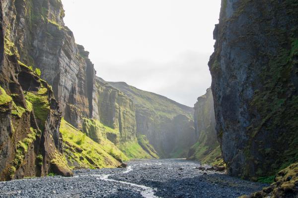
Unlike canyons viewed from above, Stakkholtsgjá lets you walk into its depths. This narrow slot canyon in Þórsmörk features 100-meter (328-foot) walls closing in overhead as you wade through shallow streams toward a hidden waterfall in a cave-like chamber at its end.
The 2 km (each way) hike takes you through multiple river crossings, so it’s a nice adventure. Game of Thrones filmed scenes nearby, using the landscape for "north of the Wall" sequences.
The Future of the Canyons in Iceland
Iceland's canyons continue to change through natural processes and human impact:
- Ongoing natural changes: Erosion from rivers and freeze-thaw cycles reshapes canyon walls. The current climate is accelerating glacial melt, potentially increasing the frequency and intensity of jökulhlaups.
- Human impact: Tourism pressure has led to trail improvements and occasional closures (like at Fjaðrárgljúfur) to protect fragile ecosystems. Hydroelectric projects have altered river flows, both revealing new canyons (such as Stuðlagil) and modifying existing ones.
- Future formation: Iceland's volcanic activity continues, with eruptions on the Reykjanes Peninsula since 2021. New eruptions under glaciers could trigger floods capable of carving new canyons or modifying existing ones.
Conservation efforts aim to strike a balance between access and protection. Most canyons now have designated viewpoints and paths to reduce the environmental impact of tourism.
Conclusion
Iceland's canyons offer a glimpse into Earth's raw power. Places where fire, ice, and water combine to create landscapes that seem to come from another world. Each canyon tells a story of geological forces, mythological connections, and the ongoing relationship between Icelanders and their dramatic landscape.

