Sólheimasandur Plane Wreck: Eerie beauty and a touch of history
Most travelers come to Iceland to chase waterfalls, geysers, volcanoes, and the Northern Lights. But other places go a little bit further, and some visitors want to explore those more unusual stories that go hand in hand with the country’s landscapes.
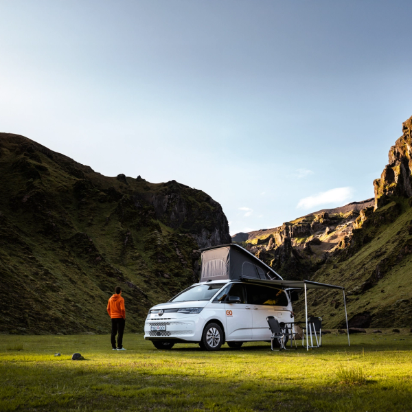
The Sólheimasandur Plane Wreck is one such tale. In the middle of a black sand beach along the south coast, we can see a U.S. Navy aircraft fuselage abandoned more than 50 years ago. This site draws adventurers who appreciate the blend of history, isolation, and raw natural beauty. For campervan explorers, it offers a chance to park nearby, hike to the wreck, and connect with a side of Iceland that is not that common. Surrounded by glaciers, volcanoes, and beautiful shores, the wreck has become a symbol of resilience against the elements.
Key Takeaways
- The Sólheimasandur Plane Wreck is the remains of a 1973 U.S. Navy plane that crashed on a black sand beach in South Iceland.
- To reach the site, you will need to park your vehicle and hike for 4 kilometers (2.5 miles) across a volcanic plain.
- The surrounding area features glaciers, waterfalls, and volcanic landscapes, making it ideal for a multi-day campervan itinerary.
What's the Sólheimasandur Plane Wreck?
There’s a location in South Iceland that looks more like a movie set than a real place. Sólheimasandur is a sand plain that by the coast becomes Solheimafjara, a black sand beach like many others in the country. These beaches are of volcanic origin, and their sand is nothing more than volcanic rocks ground by the elements over thousands of years.
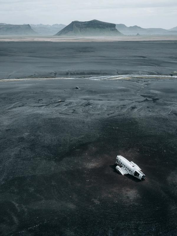
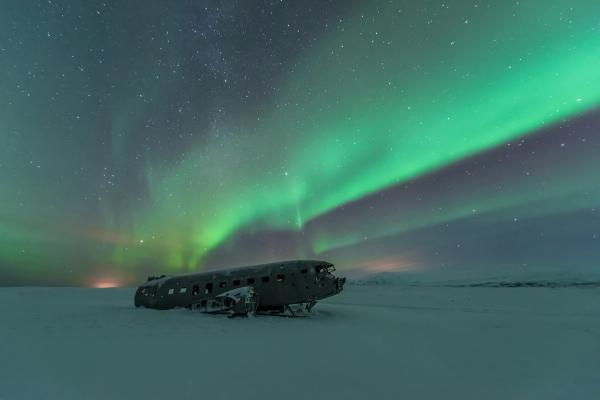
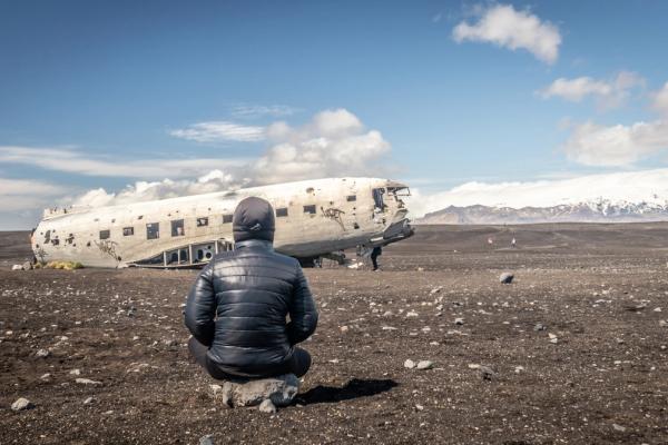
However, this one is a bit different. Here, we can find the remnants of a Douglas DC-3 aircraft that crashed here more than 50 years ago. This remote site, far from any town, has the plane's fuselage and some scattered parts; they have been stripped bare over decades by wind, sand, and salt. The beach is like a dark triangle that opens up to the Atlantic Ocean on one side, with views of a massive glacier on the other. There’s no vegetation or barely any other element, just a black desert that looks like it's on the moon. The whole view feels like a scene from a post-apocalyptic film.
The wreck's history dates back to November 21, 1973, when a U.S. Navy DC-3 was flying from Höfn to Keflavík. Some ice had formed on the wings and the engines, forcing the pilot to make an emergency landing on the frozen beach. All crew members survived unharmed and walked away from the site. The U.S. military salvaged some usable parts but left the main body behind, as recovering it was extremely difficult due to the remote location, harsh conditions, and the limited means available at the time. Over time, locals used the pieces for practical purposes, such as building sheds, but the main structure remained intact.
Today, the wreck has become a popular attraction for photographers and tourists. It’s a bit remote and it requires walking for a few kilometers to get there, but, at the same time, this makes it less crowded than other sites in the region. Also, the walk from the parking area is fantastic, surrounded by a unique landscape. The site has become a symbol of its rarity and an example of this extreme environment. If you’re traveling through Iceland in a campervan, it’s a fantastic stop to add to your route.
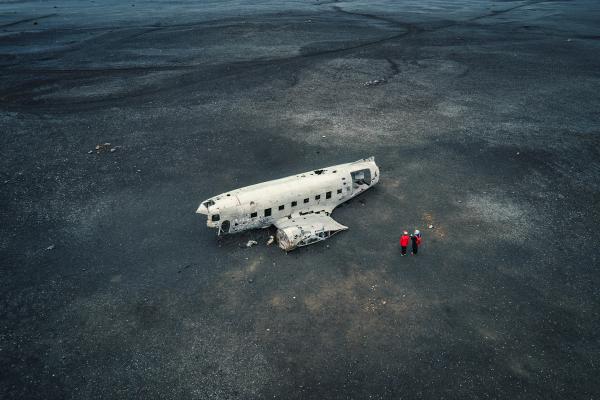
Where's the Sólheimasandur Plane Wreck and How to Get There
The Sólheimasandur Plane Wreck lies on Iceland's south coast, a few miles west of the town of Vík í Mýrdal, on the vast black sand beach of the same name. This area is part of the Katla Geopark, known for its volcanic activity and glaciers. The wreck itself is about 160 kilometers (100 miles) southeast of Reykjavík.
It’s pretty easy to get there from the capital on a day trip, but it’s even better as a stop in an itinerary through this amazing part of the country. The best way to reach it is by car or campervan, as public transport options are limited and don't drop off directly at the site.
From Reykjavík, head east on Route 1, the Ring Road, for about 140 kilometers (87 miles) until you pass Skógafoss waterfall. Continue another 10 kilometers (6 miles) east until you reach an unmarked flat gravel area on the right-hand side. There’s a short road that leads there. If you reach the bridge over the Jökulsá river, you’ve driven past it. That flat area is the parking lot from where the trail leading to the wreck begins. From there, it's a flat 4-kilometer (2.5-mile) hike one way across the sandy plain to the wreck—about 45-60 minutes each direction.
The path is unmarked but straightforward, but it can be windy and wet. The southern coast is not as cold as other parts of the country, but the open plain receives the elements straight from the ocean.
There's a shuttle service that takes you to the beach running seven days a week from 10.00 to 17.00
Things to See and Do Near the Sólheimasandur Plane Wreck
The Sólheimasandur Plane Wreck is located in South Iceland, a region renowned for its diverse array of landscapes, which range from black sand beaches to waterfalls and active volcanoes. This makes it an excellent area to explore in a campervan. Our recommendation is to create an itinerary through the region, taking into account the days you have available, and enjoy it to the fullest. You can hike to the wreck in the morning, then drive to other spots for afternoons filled with natural wonders.
Reynisfjara
Of all the black sand beaches dotted along Iceland’s coastline, Reynisfjara is one of the most beautiful and, probably, the most iconic of them all. Very close to the town of Vík í Mýrdal, it’s surrounded by dark basalt columns rising like organ pipes from the shore. In front, we can see the Reynisdrangar sea stacks, two huge rock formations. The local legends say that they are trolls turned into stone by the sun. It’s a great place to take a stroll, but be careful with the waves, known as “sneaker waves” that come out of nowhere and are surprisingly strong.
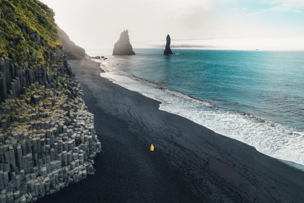
Dyrhólaey
Dyrhólaey is a dramatic promontory that rises in one of the corners of Reynisfjara Beach. There’s a lighthouse at the top, and the views of the Atlantic Ocean, the beach, and the Reynisdrangar sea stacks are astonishing. There’s also a natural stone arch just in front of it that seems surreal. It’s one of the best spots in Iceland for birdwatching, especially puffins. These funny-looking animals come to the cliffs by the promontory to nest in the summer months.

Katla Geopark
This huge area covers a huge portion of South Iceland. In fact, the plane wreck is inside Katla Geopark, which spans 9,542 square kilometers (3,684 square miles) of volcanic terrain under the influence of the Katla volcano beneath Mýrdalsjökull glacier. Inside the park, visitors can explore lava fields, hot springs, and craters via a huge network of trails. The geopark is a fantastic place to learn about geological processes, with information explaining volcanic eruptions and jökulhlaups, which are glacial floods that happen when a volcano with a glacier on top erupts.
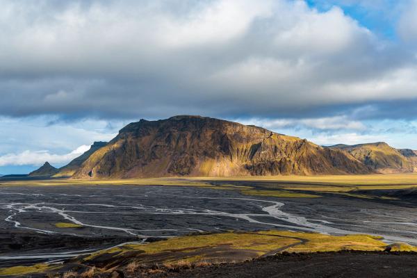
Skógafoss
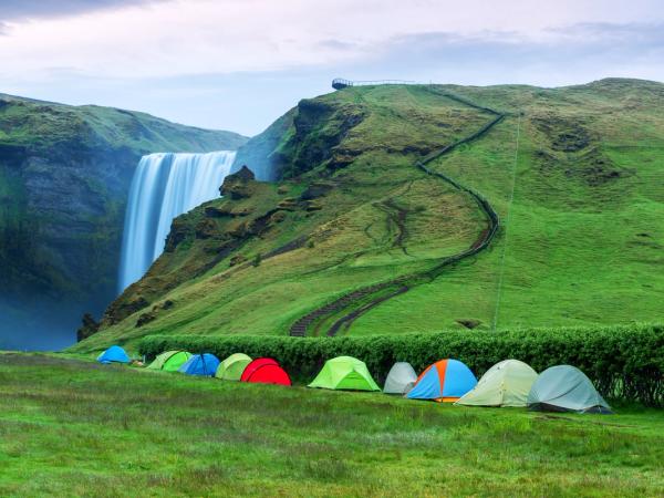
Located just 11 kilometers (7 miles) west of the wreck, Skógafoss is one of the best waterfalls in Iceland. It’s a 60-meter (197-foot) tall and 25 meters (82 feet) wide, powerful cascade that falls over a mossy cliff. There’s a staircase that goes from the base all the way up to the top. But beware, it’s 527 steps, so take your time. Once you reach the upper part, the views from there are unbeatable. There’s also a legend attached to this place that tells the story of a Viking who hid a treasure chest behind the curtain of water.
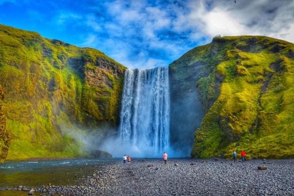
Kvernufoss
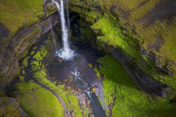
Not far from Skógafoss, there’s another waterfall that is often overlooked by tourists. A short walk from the first will take you to Kvernufoss, a 30-meter (98-foot) tall waterfall hidden inside a narrow gorge. It has a path that goes behind the water into a small cave. It’s considerably less crowded than its neighbor, but you can make the most out of your visit if you see them both.
Seljalandsfoss
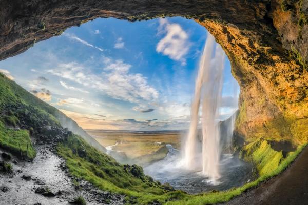
When it comes to waterfalls, few can rival the beauty of Seljalandsfoss. It’s probably one of the most visited spots in South Iceland, and for a reason. It’s a 60-meter (197-foot) waterfall with a walking path that goes behind the water for a unique point of view. It's especially striking at sunset when light filters through the spray. There’s a parking lot just by the waterfall, but you have to pay a small fee.
Gljúfrabúi
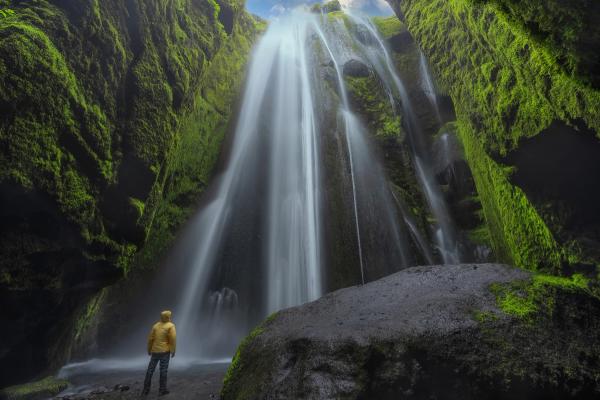
Just like it happens with Skógafoss and Kvernufoss, Seljalandsfoss has a hidden sister, just 300 meters away. Gljúfrabúi, or “the canyon dweller,” it’s a smaller waterfall hidden inside a narrow gorge. To see it, it’s necessary to wade through a swallow stream. At the end, a chamber opens up, where the water pours down over a cliff covered in moss.
Where to Stay Near the Sólheimasandur Plane Wreck
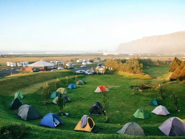
South Iceland has several campsites suited for campervans, with facilities ranging from basic to more equipped. These spots are great options to stay after a day exploring the plane wreck and other monuments in the area. Most are really close to the Ring Road, so it’s quite easy to stop and call it a day. Remember that wild camping is illegal in Iceland.
Skógar Camping Ground
Distance to Sólheimasandur Plane Wreck: 11 kilometers (6.8 miles).
Opening period: All year.
This campsite sits at the base of Skógafoss waterfall, so you can spend the night just in front of this amazing landmark. It features grassy pitches for campervans, and the facilities include electricity, restrooms, showers, and a small shop offering essentials. It’s an excellent option for hikers, as several trails depart from the camping ground.
Vík Camping Ground
Distance to Sólheimasandur Plane Wreck: 23 kilometers (14 miles).
Opening period: May to October.
Located in the village of Vík, this site features level pitches for campervans near Reynisfjara black sand beach and just by the town’s center. It has toilets, showers, electricity, and a playground for children. Being so close to the town’s center, you’re just a walk away from shops, restaurants, and a gas station. For this reason, it could be a great base to explore the south coast.
Þakgil Campsite
Distance to Sólheimasandur Plane Wreck: 44 kilometers (27 miles).
Opening period: June to September.
This place is a bit remote, but if you’re coming in summer, it’s one of the rawest experiences you can get in this region. Þakgil is a remote valley surrounded by cliffs covered in moss and green hills. And it has its own camping ground. It’s quite basic, but it has toilets, cold water, fire pits, and a cave dining area. The rough access road requires a 4x4 campervan, but the reward is a fantastic experience in a unique setting with hiking trails to waterfalls and canyons. Don’t expect too many luxuries in the campsite, but you’ll have the basics.
Hvolsvöllur Camping Ground
Distance to Sólheimasandur Plane Wreck: 58 kilometers (36 miles).
Opening period: May to October.
This campsite, located in the town of the same name, offers flat pitches for campervans and tents, along with access to toilets, showers, electricity hookups, free Wi-Fi, a washing machine and dryer, and a playground for children. It’s pretty close to the town’s center, with access to services such as a bank, post office, pharmacy, supermarket, restaurants, and a gas station.
Hellishólar
Distance to Sólheimasandur Plane Wreck: 61 kilometers (38 miles).
Opening period: All year.
Hellishólar is a large camping ground with grassy pitches for campervans and tents, as well as toilets, showers, a laundry room, electricity, and a playground for children. You’ll also find a restaurant on-site and a 9-hole golf course. There are also cottages for rent.
The Weather at the Sólheimasandur Plane Wreck
Knowing what to expect weather-wise is crucial when traveling to Iceland. The elements can have a huge impact on a road trip, so coming prepared can make a huge difference. South Iceland is not as cold as other parts of the country, but it is wetter and windier.
- Spring (April and May) brings milder temperatures of 2-7°C (36-45°F). Part of the Sólheimasandur can still be covered in snow, but it’s less probable as the weeks go by. It’s quite common to have rain and wind, and the trail can get quite muddy.
- Summer (June to August) offers the warmest weather, with temperatures ranging from 10-15°C (50-59°F), and nearly 24 hours of natural light by the end of June. This makes it possible to visit the wreck at almost any time of day. The weather is mostly fair, but there could still be occasional showers. On the other hand, it’s peak season, so expect an increase in tourists.
- In Autumn (September and October), the temperature goes down, with an average of 4-10°C (39-50°F). Rain is fairly common, the wind can be strong, and the days get increasingly shorter. On the other hand, there are not many tourists.
- Winter (November to March) sees temperatures from -1 to 4°C (30-39°F), with snow covering the sands. The days are very short, barely 4 hours of natural light by the end of December. The Ring Road remains open throughout the year, but driving conditions can be challenging. As a positive, this is the season to see the Northern Lights.
What to Pack to Visit the Sólheimasandur Plane Wreck
- Waterproof and windproof jacket and pants. The plane wreck is on an exposed site, close to the sea, and wind and rain can hit any moment.
- Sturdy hiking boots for the sandy, uneven 4-kilometer trail.
- Dressing in layers will help you cope with the elements regardless of the season. The best combo is a thermal base layer, fleece or wool for the intermediate, and the aforementioned waterproof outer layer.
- Hat, gloves, and scarf, even in summer.
- Sunglasses and sunscreen.
- Snacks and water. There are no shops or other facilities near the wreck, so come prepared.
Travel Tips
- Don’t park your campervan outside the designated area. Driving off-road is illegal and could harm the environment.
- Going early in the morning or late in the evening could help you avoid crowds.
- Visit the Sólheimasandur Plane Wreck as part of a larger itinerary through South Iceland to make the most out of your trip.
- Do not climb the remains of the plane. Some people do, causing damage to the fuselage. Leave the place as you found it so others can enjoy it, too.
- The Ring Road is maintained in good conditions year-round, but check the road status, especially in winter, before setting out.
- Download tide charts, as nearby beaches like Reynisfjara have dangerous waves.
Conclusion
The Sólheimasandur Plane Wreck is one of those sites that create a memory that is difficult to forget. Here, nature and history go together to create something unique. It’s a rare and unique place, extremely photogenic, and surrounded by other natural monuments that will enhance your visit. Rent your campervan, create an itinerary through the region, and enjoy your Icelandic adventure.

