Brúarfoss Waterfall, a blue jewel in the heart of the Golden Circle
Nature has decided to go the extra mile in Iceland. The country is a collection of amazing natural monuments, each one more impressive than the previous.
Of all the waterfalls on this Nordic island, some have gained international fame and are visited by thousands of tourists every year. However, others are not that well-known and are often skipped by visitors, missing something extremely beautiful. That’s the case of Brúarfoss, a blue glacial waterfall in southwest Iceland. It’s part of the Golden Circle, the most famous scenic route in the country. Brúarfoss is considered a secondary stop in this loop; it’s almost hidden, but it rewards with an astonishing sight to those who make their way to see it.
Come with us to discover this hidden gem.
Key Takeaways
- Brúarfoss is a waterfall located in southwest Iceland.
- It’s also referred to as the “blue waterfall” because of the intense color of its waters.
- The name can be translated as “bridge waterfall.”
What's Brúarfoss Waterfall?
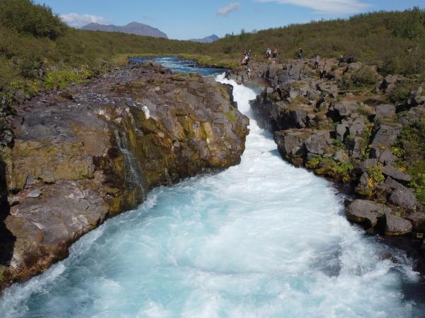
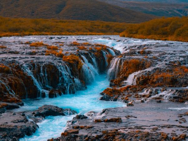
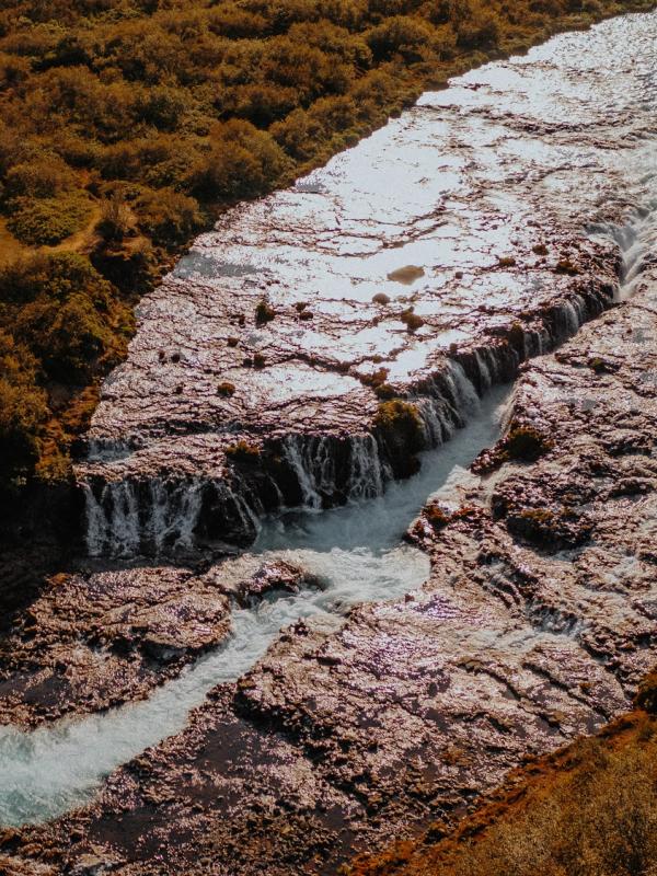
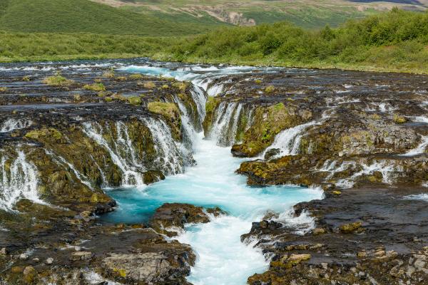
There’s a waterfall in southwest Iceland that feels like a secret waiting to be discovered. Its name is Brúarfoss, a charming cascade that is part of the Golden Circle, the most popular scenic route in the entire country. Well, more than one, it looks like several different waterfalls. The course of the Brúará River here is split by basalt rocks, forming a series of small cascades that shine with their intense color against the dark rocks. Some of these rocks are covered in bright green moss, creating an even bigger contrast.
This, specifically, is what surprises visitors the most: the colors. The waterfall itself is of an intense turquoise hue. The Brúará River originates in the Langjökull glacier, the second-largest glacier in Iceland. This also means that late spring and early summer are the moments where the river, and subsequently the waterfall, is at its best, due to the increased flow caused by snowmelt. It’s not the tallest or grandest of Iceland’s waterfalls, but its beauty makes it stand out.
However, what makes Bruarfoss special goes beyond its looks. Centuries ago, there was a natural stone bridge that arched over the river here. That’s what gave the waterfall its name, as Brúarfoss means “Bridge Waterfall,” even if there’s no bridge nowadays. It’s believed that the bridge collapsed due to natural reasons, but a story claims it was destroyed in the 1600s during a famine to block desperate locals from reaching fertile fields.
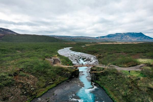
The area where Brúarfoss lies is perfect for a road trip. It’s all well-connected by road, making it easy to travel from one attraction to the next. This waterfall is a bit secluded. You’ll need to park your campervan by the road and then hike for 3.5 kilometers (2.2 miles) each way to get there. The trail is easy and has fantastic views, so it’s part of the adventure.
Facts about Brúarfoss Waterfall
As we explained before, the name Brúarfoss translates to "Bridge Waterfall" in Icelandic, reflecting the natural stone arch that once crossed the river here. It's sometimes spelled Brúararfoss, but both refer to the same site. So, if you see that spelling in a map or road sign, don’t worry, you’re going to the right place.
The waterfall stands about 3 meters (10 feet) tall. This is relatively short compared to some other tall waterfalls in Iceland. It spans roughly 10 meters (33 feet) wide, with multiple cascades flowing side by side. It has a crescent or horseshoe shape. The turquoise waters fall over the basalt rocks, of volcanic origin, creating a white whirlwind in the pool below.
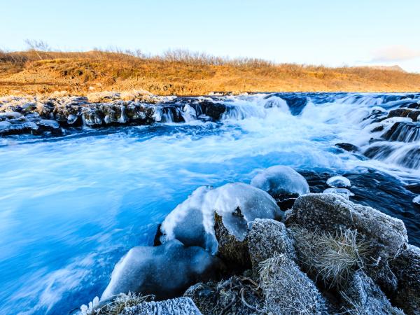
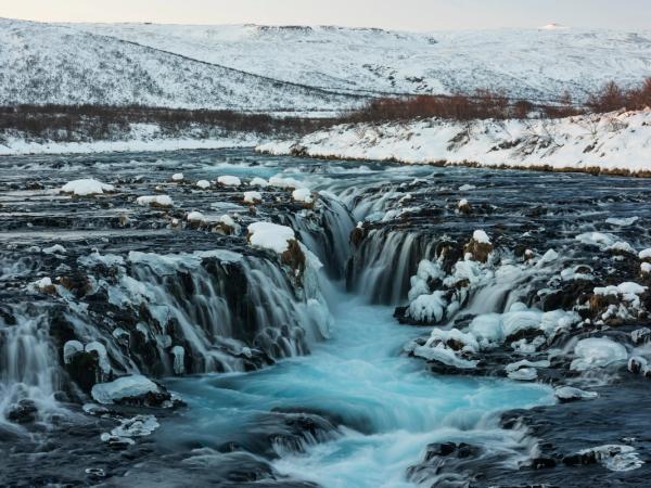
The waterfall is part of the Brúará River, which is fed by several springs that are the result of the snowmelt of Langjökull. The water gets its distinctive color from the ice and is full of minerals. The river's flow changes with the seasons, peaking in early summer with snowmelt and slowing in winter. In this season, parts of the waterfall freeze, creating a spectacular image. As part of the Golden Circle area, it's accessible year-round.
Where's the Brúarfoss Waterfall and How to Get There
Bruarfoss is located in southwestern Iceland, about 90 kilometers (56 miles) east of Reykjavik. Getting there from the capital is quite easy, making it a great destination for a day trip, but as this region is so full of wonders, you might consider doing a road trip through this area and stopping there. Either way, the best way to reach it is by car or campervan, giving you the freedom to explore at your own pace and camp nearby. Public transport options are limited, so self-driving is probably the best option.
From Reykjavik, start heading north on Route 1, the Ring Road, for about 18 kilometers (11 miles) until you reach the city of Mosfellsbær. Once you’ve crossed the city, turn right onto Route 36, the road that goes towards Þingvellir National Park, and continue for about 45 kilometers (28 miles). Then, take Route 365 to Laugarvatn, and from there, take Route 37, which leads to Brúarfoss.
After 14 kilometers (8.7 miles) on said road, you’ll see a gravel road to the left with a sign that says Brúarfoss. Take it until you reach the parking area. The other option is to continue on Route 37 a few more meters until you pass the bridge over the Brúará River. Just after, there’s a parking area on the left from where the Brúará Trail begins. It’s a 3-kilometer (1.8 miles) hiking path, each way, that goes along the river until getting to the waterfall. The trail is quite beautiful, and you’ll pass two other beautiful waterfalls along the way.
The drive takes around 1.5 hours under normal conditions, but the weather can significantly impact the roads, so check the conditions before departing. In winter, some secondary roads may close due to snow.
What to See and Do Near Brúarfoss Waterfall
Brúarfoss is a great destination by itself, but it’s even better if you combine it with other natural monuments. Luckily, there’s a lot to see nearby. The waterfall is part of the Golden Circle, a 300-kilometer (186-mile) loop that connects the best attractions in this part of the country.
Hlauptungufoss and Midfoss
Along the hiking trail to Bruarfoss, you'll encounter Hlauptungufoss and Midfoss, two smaller waterfalls on the same river. Hlauptungufoss, about halfway in, drops gently over mossy rocks. It’s a nice and peaceful spot for a break. Midfoss follows soon after, a bit wider and more powerful than the first. These two stops make the visit even better. These waterfalls are part of the Brúará Trail, so you won’t see them if you choose the first route that we proposed before.
Þingvellir National Park
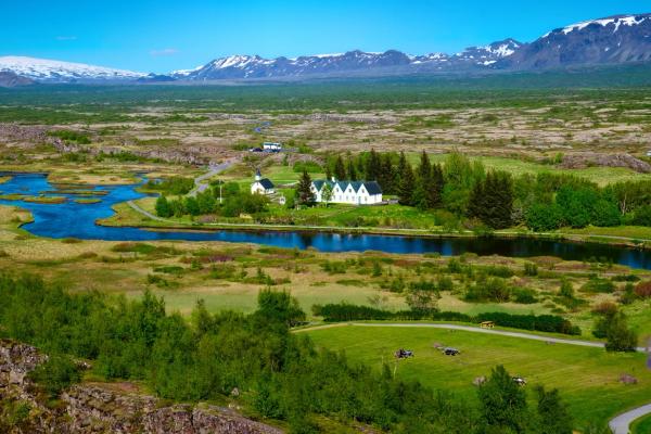
This national park, one of three in Iceland, is one of the three main stops on the Golden Circle. Þingvellir National Park marks the spot where the North American and Eurasian tectonic plates pull apart. This can be seen above the ground, walking through the Almannagjá Gorge, or underwater in the Silfra Fissure. In the latter, you can swim touching both plates at the same time. The park is also very important in the history of Iceland. In the year 930 AD, the Icelandic parliament, Alþingi, was first established here. It’s the oldest running parliament in the world. Other incredible sights in this UNESCO World Heritage site are Þingvallavatn Lake and Öxarárfoss waterfall.
Gullfoss
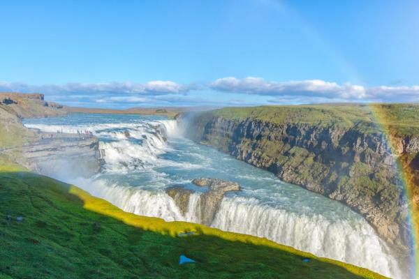
Not far from Brúarfoss, you'll find the second main stop in the Golden Circle. Gullfoss, also known as the “Golden Falls,” is a powerful two-tiered waterfall with a total drop of 32 meters (105 feet) on the Hvitá River. It gets its name because of the colorful effect that sun rays create on the mist. There are two viewing platforms. One gets you closer to the waterfall while the other offers a more panoramic view.
Geysir Geothermal Area
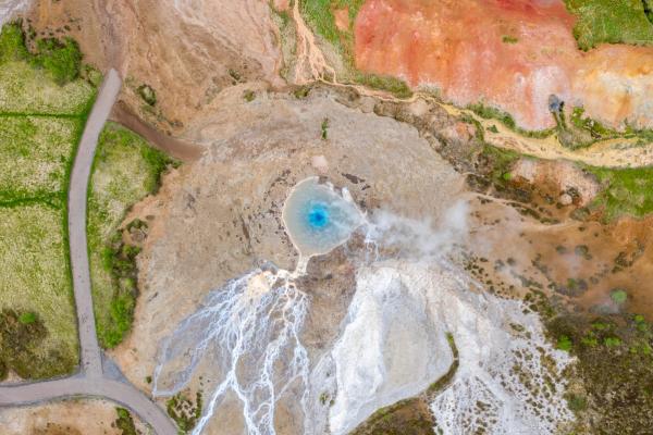
The third main stop in the Golden Circle is one of the most active geothermal areas in Iceland, full of bubbling mud pots, hot springs, mineral deposits, steam vents, and geysers. The star here is the Strokkur geyser, that erupts every 5 to 10 minutes shooting water 20 meters (68 feet) up in the air. The Great Geysir, nearby, is now dormant, but it gave the word geyser to the rest of the world. There are several trails that allow visitors to explore the area on foot.
Kerið Crater
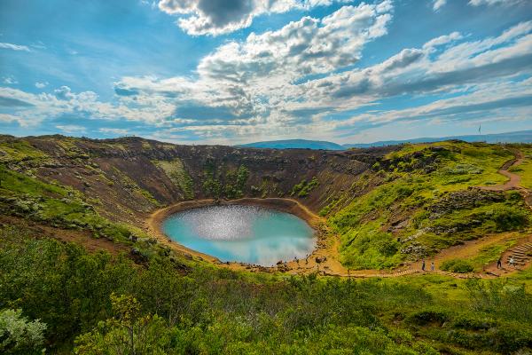
Around 30 kilometers (19 miles) southeast, Kerið is a 3,000-year-old volcanic crater filled with blue water. It’s considered young in geological terms, so its shape is remarkably well-preserved. The walls of the crater are red and black, creating a striking contrast with the color of the water. There’s a path that goes along the rim, offering great views of the crater and the landscapes around. There’s another trail that goes all the way down to the lake’s shore.
Laugarvatn Fontana
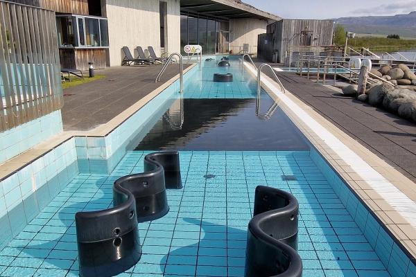
A trip to Iceland can’t be considered complete without a visit to one of its many geothermal spas or natural hot springs. Luckily, there are two great options near Brúarfoss. The first is Laugarvatn Fontana, a modern spa by the shore of the Laugarvatn Lake. It features two outdoor hot pools, at 36 °C (97°F) and 40°C (104°F), respectively. There’s also a hot tub with panoramic views and steam rooms built directly over hot springs. This spa has a unique element: a geothermal bakery. Visitors can see how bread is baked, buried in the ground.
Secret Lagoon
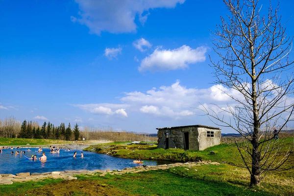
The other option is the Secret Lagoon, in the town of Flúðir, the oldest geothermal pool in Iceland. It’s a natural hot spring, with a constant temperature of 38-40°C (100-104°F) year-round. Surrounded by geysers and steam vents, it’s a more rustic approach to geothermal bathing, but still has a changing room and a café.
Friðheimar
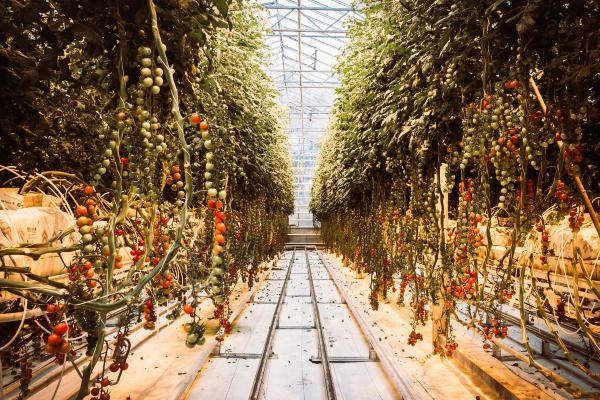
Friðheimar is a greenhouse farm that uses geothermal heat to grow tomatoes. You can take a guided tour through the facilities and, afterwards, enjoy tasting tomato-based recipes in the restaurant. It's a unique look at sustainable Icelandic agriculture, perfect for a meal stop.
Where to Stay Near Brúarfoss Waterfall
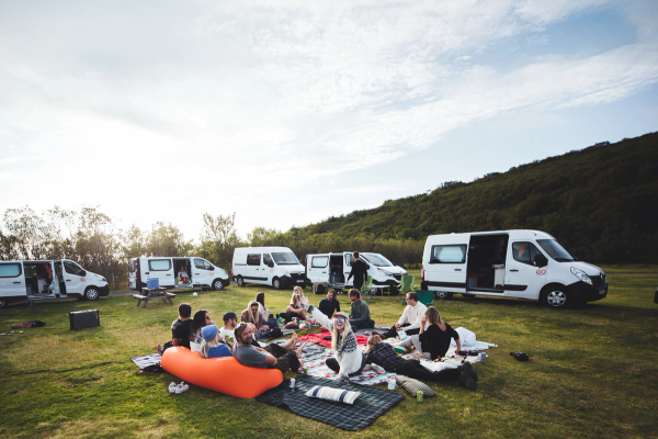
If you’re making a road trip through this area, you’re going to need, at least, a couple of days to enjoy everything. The good news is that there are plenty of options for campervan travelers to spend the night. Here, you'll find some of the best camping spots in the area. Please note that wild camping is strictly prohibited in Iceland.
Uthlid Cottages
Distance to Brúarfoss: 10 kilometers (6.2 miles). Opening Period: Year-round.
This site is located in a beautiful rural setting, with pitches for campervans sheltered by trees. It has toilets, showers, electricity, a laundry room, a restaurant with free Wi-Fi, a swimming pool, a playground for children, and hot tubs. They also have cottages for rent if you want a more comfortable stay. The camping area is big enough and there’s no need to book in advance.
Geysir Camping Site
Distance to Brúarfoss: 18 kilometers (11.2 miles). Opening Period: May to September.
Located by the Geysir Geothermal Area, this site provides spacious pitches for vans. It has toilets, showers, electricity, Wi-Fi, and a washing machine. There’s a restaurant across the road, and there’s even a golf course nearby. The setting makes it unique, but it can get quite busy during peak season.
Skjól Camping Ground
Distance to Brúarfoss: 22 kilometers (13.6 miles). Opening Period: May to September.
Halfway between Gullfoss and Geysir Geothermal Area, Skjól is a well-equipped campsite with toilets, showers, electricity hookups, free Wi-Fi, BBQ area, and a playground for children. It also has a bar that serves food and drinks.
Faxi Camping Ground
Distance to Brúarfoss: 18 kilometers (11 miles). Opening Period: May to September.
Located on the banks of the Tungufljót River, this camping ground is really close to a small but beautiful waterfall. It has grassy pitches and toilets, cold water sinks, electricity, and picnic tables. There’s also a café on site that serves meals and drinks.
Flúðir Camping Ground
Distance to Brúarfoss: 24 kilometers (15 miles). Opening Period: May to September.I
n Flúðir village, this site provides campervan spots with modern facilities. It features toilets, showers, Wi-Fi, laundry, outdoor BBQ area, and a playground. It also has a small shop for basics like food and camping supplies.
Laugarvatn Camping Ground
Distance to Brúarfoss: 15 kilometers (9 miles).
Opening Period: June to September.
It’s located in the town of Laugarvatn, close to the lake and the Fontana. This site offers leveled pitches for vans, featuring amenities such as toilets, showers, electricity hookups, Wi-Fi, dishwashing sinks, and washing machines. It’s a great place to use as a base to explore the area. The town has services such as a gas station, shops, cafés, and restaurants.
The Seasons at Brúarfoss Waterfall
Summer (June to August) brings mild temperatures of 10-15°C (50-59°F) and long daylight hours, perfect for hiking the trail and seeing the blue waters in full flow under natural light. The weather is stable, but there are always chances for sudden rain. It’s peak season, so expect more tourists, although Brúarfoss remains relatively quiet. In this season, it’s highly recommended to book campsites in advance.
Autumn (September to October) cools to 5-10°C (41-50°F), with fewer visitors. The vegetation gets beautiful fall colors, making the trail to the waterfall especially enchanting. On the other hand, the trail can be muddy, as rain is common. Some campsites start to close for the season.
Winter (November to March) drops to -5 to 0°C (23-32°F), transforming the falls with ice and snow for a different, beautiful view. The days are very short, barely 4 to 6 hours of daylight, so plan your visit to the waterfall for those moments. The snow can cause delays in road travel and some roads, especially secondary ones, can be closed, so check the conditions before departing.
Spring (April to May) warms to 0-10°C (32-50°F), with melting snow making the river and the waterfall look at their best. There still can be snow and ice on roads and paths, so tread carefully. The chances of rain and wind are quite high.
What to Pack to Visit Brúarfoss Waterfall
- Waterproof hiking boots for muddy or wet trails.
- Layered clothing, including thermal base layers and fleece, to handle the ever-changing weather.
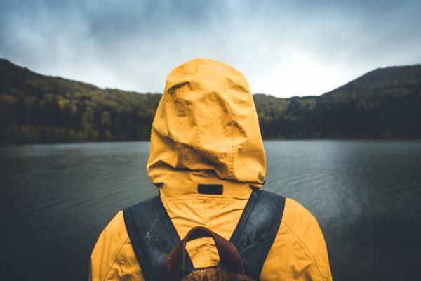
- Waterproof and windproof jacket and pants for rain protection.
- Hat, gloves, and scarf, even in milder seasons. The nights in summer can be quite chilly.
- Snacks and water, there are no shops by Brúarfoss.
- Camera or phone for photos.
- Backpack with rain cover for essentials.
Travel Tips
- Arrive early in the morning to avoid tour groups and enjoy a quieter experience, particularly during summer. Late in the evening can also be a good option in the warmer months.
- Stick to marked paths to protect the delicate environment around the waterfall and river.
- Fuel up in cities or towns, as gas stations are scarce along the Golden Circle route.
- Wear sturdy, waterproof hiking shoes for the trail, which can get muddy.
- Carry water and snacks, as there are no facilities like restrooms or cafes at the parking area.
- In summer, many campsites fill up quickly, so book in advance to secure your preferred camping ground.
- Use a weather app to stay prepared for sudden changes, which are quite common in Iceland.
- Leave no trace—respect the natural surroundings by taking litter and waste with you.
Conclusion
Although Iceland has become a popular travel destination in recent years, there are still some places that remain hidden and are not that frequented by tourists. Brúarfoss is undoubtedly one of them. Many of the travelers who make the Golden Circle skip this hidden wonder, missing a sight that is difficult to equal. However, those who make their way to this beautiful waterfall are often left speechless. Rent your campervan, plan your route, and discover the magic of Brúarfoss.

