Cliffs, puffins, and a stone arch in South Iceland: Dyrhólaey
In South Iceland, the sea and the land come together to create some of the most beautiful landscapes in the country. This region is one of the most visited in Iceland, and with reason. There are countless waterfalls, volcanic fields, long black sand beaches, huge glaciers, historic sites, and varied and rich wildlife. And, in certain places, many of these elements combine to create unique views.
One of them is Dyrhólaey, a promontory that rises above the sea and where puffins can be seen in large numbers. A location that some travelers miss but that should be in your radar for your campervan adventure through this beautiful Nordic country.
Key Takeaways
- Dyrhólaey is a rock promontory located on the southern coast of Iceland.
- It has beautiful views of the sea and the surrounding landscapes, like the famous Reynisfjara beach.
- Dyrhólaey is one of the best places in Iceland to see puffins.
What’s Dyrhólaey?
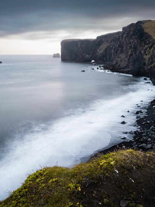
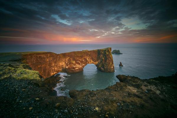
Dyrhólaey, meaning “Door Hill Island,” is a breathtaking promontory on Iceland’s South Coast. It’s mainly known for its iconic stone arch, towering cliffs, and vibrant wildlife. There’s a lighthouse on top that is a very important reference for maritime navigation in the North Atlantic Ocean. The cliffs reach up to 120 meters high (393 feet), and the panoramic views of the sea are breathtaking.
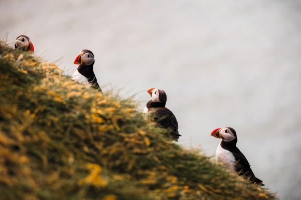
In front, you’ll see the Dyrhólaey Arch, a massive rock formation sculpted by centuries of crashing waves and sweeping winds. It’s, by far, one of the most iconic vistas in Iceland. The cliffs are not only beautiful and impressive, but they are also full of life, particularly from May to August. In the summer months, the Atlantic puffin comes to nest on the cliffs and grassy slopes. They can be seen waddling with their colorful beaks or flying through the air, diving down to catch some fish. But they are not the only species here. There are many more, such as fulmars and kittiwakes.
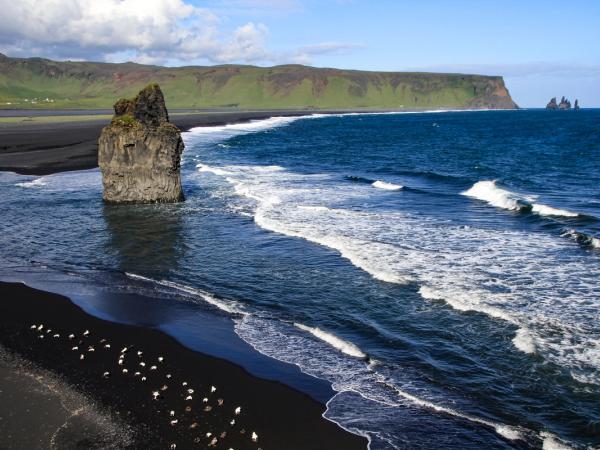
Below, Reynisfjara stretches towards the east. This beach is one of the most iconic and photographed in Iceland. It’s the perfect example of the black beaches of volcanic origin present on the island. Reynisfjara is framed by hexagonal basalt columns, with the impressive Reynisdrangar stacks rising from the sea. These formations are not only spectacular to see, but they also have a legend attached to them. Local stories claim that they were trolls who were turned to stone by the sun.
Reynisfjara beach is a great place to take a quiet stroll, contemplating all the natural beauty around you. But you’ve got to be careful. The tides and waves here are surprisingly strong. The infamous “sneaker waves” in Reynisfjara come out of nowhere and can be very dangerous, so mind your distance from the shore.
Where’s Dyrhólaey and How to Get There?
As mentioned earlier, Dyrhólaey is on Iceland’s south coast, about 174 kilometers (108 miles) southeast of Reykjavík. The closest town is Vík í Mýrdal, one of the most important cities in South Iceland.
If you’re coming from the capital, the itinerary is quite easy to follow. Start by taking the famous Ring Road, whose official name is Route 1 (Hringvegur in Icelandic), heading east, passing through Hveragerði, Selfoss, and Hella. After 170 kilometers (105 miles), just after passing the sign to the village of Skeiðflöt, you’ll see a sign pointing right to Dyrhólaey and Route 218. This narrow road is mostly paved, but turns into gravel by the end. The road splits into two free parking areas: a lower lot near the cliffs, ideal for viewing Reynisfjara and the arch, and an upper lot by the lighthouse, offering 360-degree vistas.
The upper lot requires a steep climb, so drive carefully, especially in a 2WD campervan, and avoid it during rain or high winds. During puffin nesting season (May to mid-June), access may be restricted from 6 PM to 9 AM to protect wildlife, so plan accordingly.
Where to Stay in Dyrhólaey and Nearby
There are no camping areas or places to stay with your campervan at Dyrhólaey. Luckily, there are a few within driving distance where you can spend the night. Remember that free camping is forbidden in Iceland. You can’t just park wherever you want and sleep inside. Here you have six fantastic options.
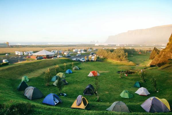
Vík Campsite
Distance: 18 km (11 miles) from Dyrhólaey. Facilities: Toilets, showers, electricity, and a playground. Opening Period: May to October.
Vík i Mýrdal is one of the main cities in South Iceland, and, good news, it has its own camping ground a few minutes from Dyrhólaey. The campsite has all the basics needed for a campervan stay. On top of that, the town’s center is quite close, and offers a grocery store, restaurants, and easy access to Reynisfjara Beach. Vík is a great place to use as a base to explore the south coast.
Skógar Camping Ground
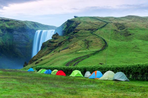
Distance: 25 km (15 miles) from Dyrhólaey. Facilities: Toilets, showers, electricity, grassy camping area, and a restaurant. Opening Period: All year.
This campsite is located beside the majestic Skógafoss waterfall, and combines basic amenities with impressive natural surroundings. It is possible to camp in tents, vans, or caravans all year round. Reservations are not required.
Þakgil Camping Ground
Distance: 36 km (22 miles) from Dyrhólaey. Facilities: Toilets, cold water, fire pits, and cave dining area. Opening Period: June to September.
This place is as raw and wild as Iceland can get. Þakgil is a remote valley surrounded by cliffs covered in moss and green hills. And it has its own camping ground. The rough access road requires a 4x4 campervan, but the reward is a fantastic experience in a unique setting with hiking trails to waterfalls and canyons. Don’t expect too many luxuries in the campsite, but you’ll have the basics.
Volcano Huts Þórsmörk
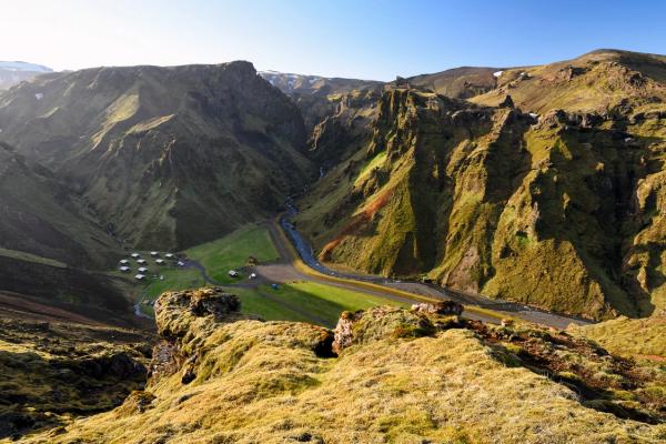
Distance: 80 km (50 miles) from Dyrhólaey. Facilities: Toilets, hot showers, electricity, restaurant, bar. Opening Period: All year.
Set in the beautiful Þórsmörk valley, this campsite is a paradise for nature lovers, surrounded by glaciers and hiking trails. The journey involves F-roads, so a 4x4 campervan is necessary, especially outside summer. They have different options to stay: camping in a tent or campervan, mountain huts, private rooms, cottages, and glamping tents.
Básar Camping Ground
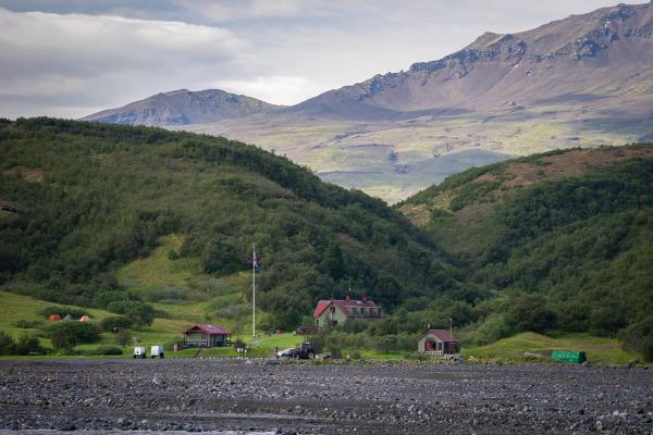
Distance: 81 km (60.6 miles) from Dyrhólaey. Facilities: Toilets, hot showers, cabins. Opening Period: June to September.
Also in Þórsmörk, Básar offers a simpler camping experience with basic facilities in a stunning natural setting. Ideal for hikers, it’s close to trails leading to glaciers and volcanic landscapes. A 4x4 campervan is mandatory due to the rugged access roads. It’s a budget-friendly choice compared to its neighbor, for those prioritizing scenery over amenities.
Hvolsvöllur
Distance: 72 km (44.7 miles) from Dyrhólaey. Facilities: Toilets, showers, electricity, Wi-Fi, playground for kids, and swimming pool. Opening Period: May to November.
This modern campsite near the Ring Road, just outside the town of Hvolsvöllur, is a practical base to explore the region. Its proximity to shops and restaurants makes it a reliable choice for campervan travelers.
Most campsites don’t require reservations, but booking with the app Parka during peak season (July-August) is highly recommended. The Iceland Camping Card, valid at Vík and Hvolsvöllur, is a smart investment for multi-site trips.
The Weather at Dyrhólaey
If there’s something characteristic about Icelandic weather, it’s unpredictable and changes rapidly. The south of the country is not as cold as the north or the Central Highlands, but it is windier and wetter. Dyrhólaey’s location, on the coast, adds a layer of variability.
Spring (April and May)
Expect temperatures of 0-5°C (32-41°F), with frequent rain, drizzle, and medium to strong winds. Puffin nesting season begins, so access to some areas may be limited. The daylight hours grow longer each week, offering more time for exploration. On the other hand, the conditions are usually wet, and the trails might be muddy. Pack extra layers for sudden cold snaps.
Summer (June-August)
The warmest season, with highs of 10-15°C (50-59°F). By the end of June, the sun barely sets. Rain is still common, but not as much, combined with sunny spells. It’s the busiest season, so it’s important to book in advance or arrive early to the camping grounds to secure a spot.
Autumn (September and October)
Temperatures range from 2-8°C (36-46°F), with shorter days, but the landscape changes colors gradually. Storms and high winds are frequent, and the first days of snow can arrive by the end of the season.
Winter (November-March)
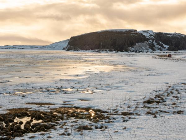
Harsh and cold, with temperatures from -5 to 2°C (23-36°F) and just 3-5 hours of daylight. The conditions on the road can be quite challenging, as ice and snow can make roads difficult or even impassable. In fact, many roads close for the season, especially the F-roads. It’s almost compulsory to drive a 4x4 vehicle, and many campsites are closed as well.
What to Wear at Dyrhólaey
As we have just seen, the weather at Dyrhólaey can be a tad difficult to deal with, but there’s nothing that can’t be solved if you prepare well.
- Waterproof jacket and pants: Essential for rain and ocean spray, especially near the cliffs.
- Insulated, windproof layers: The best way to cope with the ever-changing conditions is to wear layers. A thermal base layer, fleece or wool as intermediate, and topping off with the waterproof jacket.
- Sturdy hiking boots: Waterproof with good grip for rocky, slippery trails.
- Hat and gloves: Even in summer, temperatures can suddenly drop or the nights can be surprisingly chilly. Absolutely non-negotiable in winter.
- Sunglasses and sunscreen: Bright summer days and snow reflection in winter can harm your eyes and skin.
- Quick-dry clothing: Ideal for layering and staying comfortable in damp conditions.
Keep extra gear in your campervan for quick changes. Additionally, having an extra pair of comfortable shoes can make the trip back to the campsite much more comfortable if yours get wet or for driving.
What to See and Do Near Dyrhólaey
The South Coast around Dyrhólaey is full of amazing natural attractions. One of the best ways to visit Dyrhólaey is to create an itinerary through the region and add it as a stop.
Vík í Mýrdal
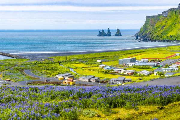
This quaint coastal village is a great place that goes beyond being just a practical stop. It has a beautiful black sand beach, close to Reynisfjara, from where you can see the Reynisdrangar sea stacks. The church of Vikurkirkja, on top of a hill, offers great panoramic views. Visit local spots like Smiðjan Brugghús for craft beer or the wool shop for authentic Icelandic souvenirs. Take the opportunity to fill up the tank in the gas station.
Sólheimasandur Plane Wreck
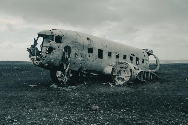
In 1973, a US Navy DC-3 plane crashed in Sólheimasandur due to a fuel shortage. While all crew members survived, the aircraft was left behind and has become an increasingly popular destination. The contrast between the white remains against the black sand is quite impressive. You’ll need to walk a bit, though. It’s a 7-km round trip from the parking area, and takes around 1.5 to 2 hours to fully see it. Bring water, wear sturdy shoes, and avoid climbing the wreck to preserve it for future visitors.
Þakgil
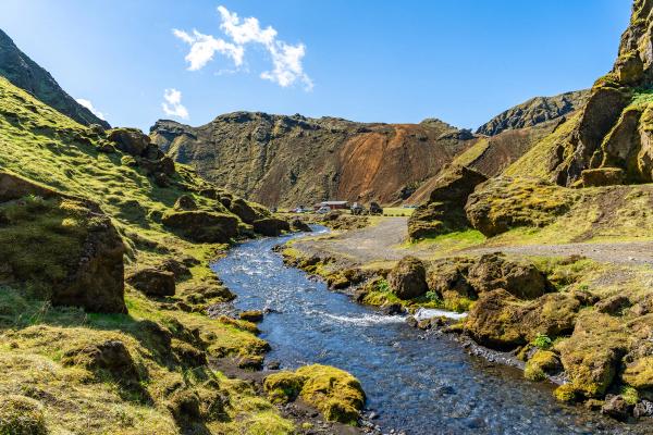
Hidden in a green valley, Þakgil feels like a secret escape from the South Coast’s busier sites. It’s a narrow valley surrounded by cliffs covered in green moss that shield it from the fierce winds that often whip across the island. The most striking thing about its look is the contrast of colors and textures. There are lots of hiking trails that go through canyons and get to different viewing points, with vistas of black volcanic deserts and green slopes. It’s only accessible during the summer months.
Eldhraun Lava Field
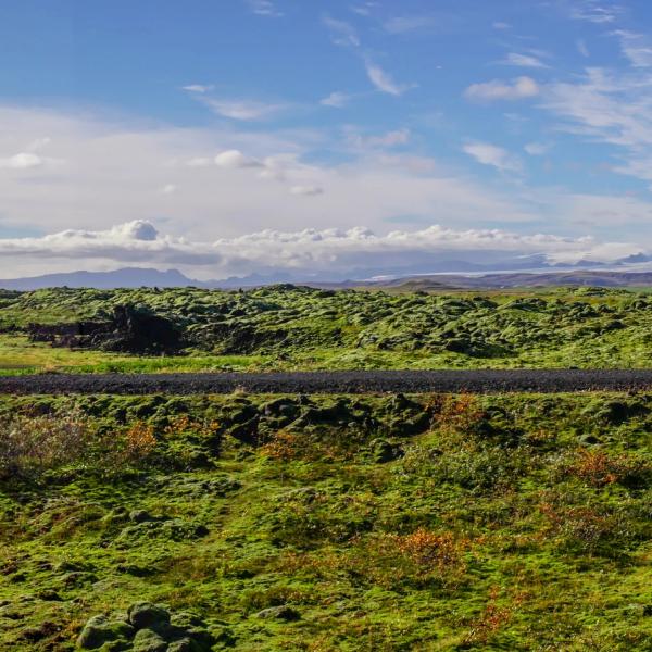
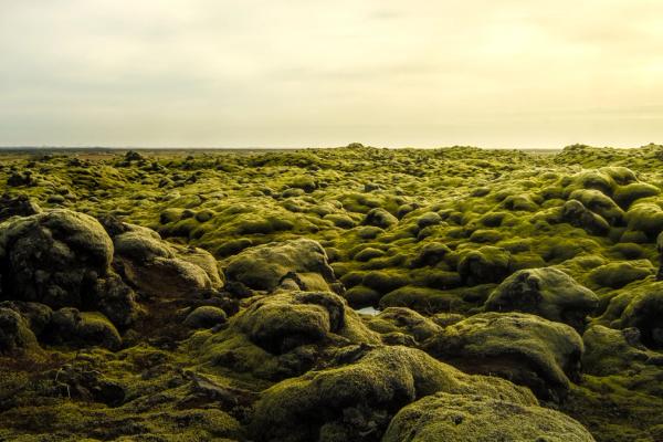
This vast expanse of moss-covered lava feels like you’re visiting a different planet. It was formed during the catastrophic Laki eruptions of 1783-1784 that reshaped the south of Iceland. It even altered the climate of several places around the planet. Today, it’s a peaceful area with a large network of hiking trails to see it all. Remember that stepping onto the moss is forbidden, as the damage created by doing so could take decades to recover.
Kvernufoss
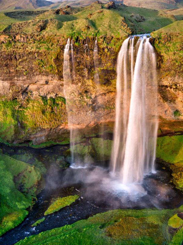
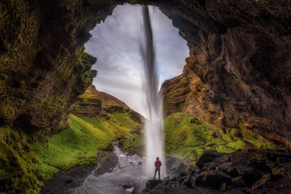
There are many waterfalls in South Iceland, and some of them, like Seljalandsfoss or Skogafoss, are quite famous. However, there’s a handful of lesser-known cascades that are equally attractive. One of them is Kvernufoss, a 30-meter water drop into a narrow gorge. You can leave your campervan in the parking area at Skógar Museum and take a short, easy hike to the waterfall.
Travel Tips
- Respect Puffin Season Closures: From May to mid-June, parts of Dyrhólaey may close between 6 PM and 9 AM to protect puffins’ nests. Plan visits during daytime hours to have freedom of movement.
- Drive with Care: The steep, gravel road leading to the upper parking lot can be tough on 2WD campervans. If it’s raining or it’s quite windy, stick to the lower lot to avoid slipping or damage.
- Camping: In summer, many camping grounds fill up quickly. While it is not strictly necessary to book in advance, it would be advisable in certain campsites. If not, try to arrive early.
- Protect the Environment: Stick to marked paths to preserve Dyrhólaey’s fragile ecosystem. Don’t disturb the puffins or get too close to them.
- Refuel Strategically: Gas stations are sparse outside towns and cities. Plan your route and locate gas stations beforehand to avoid running low.
- Use Offline Maps: Cell service can be spotty, so download maps to use offline or bring an old-school paper one.
Conclusion
Certain places in Iceland make you feel truly connected to the country. And Dyrhólaey is one of them. Here, you’ll find several of the elements people travel far north to discover. There are black sand beaches, amazing views, an astonishing surrounding landscape, cliffs, and, of course, puffins. It’s a place far from civilization, but well-connected in case you need something. And there are several great camping options in the area to spend the night.

