8 Incredible Hikes in Vatnajökull National Park
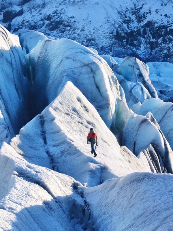
Vatnajökull National Park is Iceland at its most elemental—where fire and ice collide across a vast, shifting landscape of glaciers, volcanic ridges, and wild highland plateaus. Covering 14% of the country, this UNESCO-listed expanse holds some of Iceland’s most arresting scenery: blue ice caves and black volcanic sands, steep-walled canyons and glacier-fed rivers carving through green valleys.
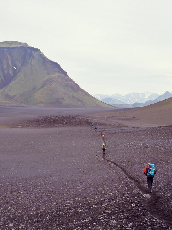
For those exploring the Southeast corner of Iceland, one of the most accessible areas of this vast National Park, you’ll find plenty of incredible hiking to immerse you in the epic scenery. From quiet trails just steps from the Ring Road to multi-hour climbs into glacier-strewn wilderness, these eight routes reveal a side of Vatnajökull that you can’t see from the roadside.
1. Svartifoss Waterfall (Skaftafell)
Distance: 3.4km round trip (2.1 miles) Duration: 1–2 hours Difficulty: Moderate Start Point: Skaftafell Visitor Centre Parking: 1000 ISK (around $7 USD)
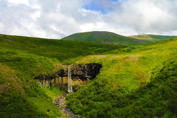
Framed by jet-black basalt columns that look almost too geometric to be natural, Svartifoss (“Black Falls”) is one of Iceland’s most photographed waterfalls — and for good reason. The trail to reach it is a short, rewarding climb that begins at the Skaftafell Visitor Centre, winding steadily uphill through birch scrub and volcanic heath.
The waterfall itself feels like a revelation. Set in a bowl of lava rock and surrounded by forest, it has a quiet, sculptural beauty that contrasts with the raw power of the water. The route also passes smaller cascades and a few striking viewpoints that make it feel like more than just a box-ticker.
It’s the most popular hike in the Skaftafell region but still manages to feel intimate — especially in the early morning or late afternoon. And if you want to extend the hike, the trail links with other longer loops that climb higher into the park, offering glacier views and more solitude the further you go.
2. Morsárdalur Valley (Skaftafell)
Distance: 18–20km return hike; varies with route (11–12.4 miles) Duration: 6–8 hours Difficulty: Moderate to Challenging Start Point: Skaftafell Visitor Center Parking: 1000 ISK (around $7 USD)
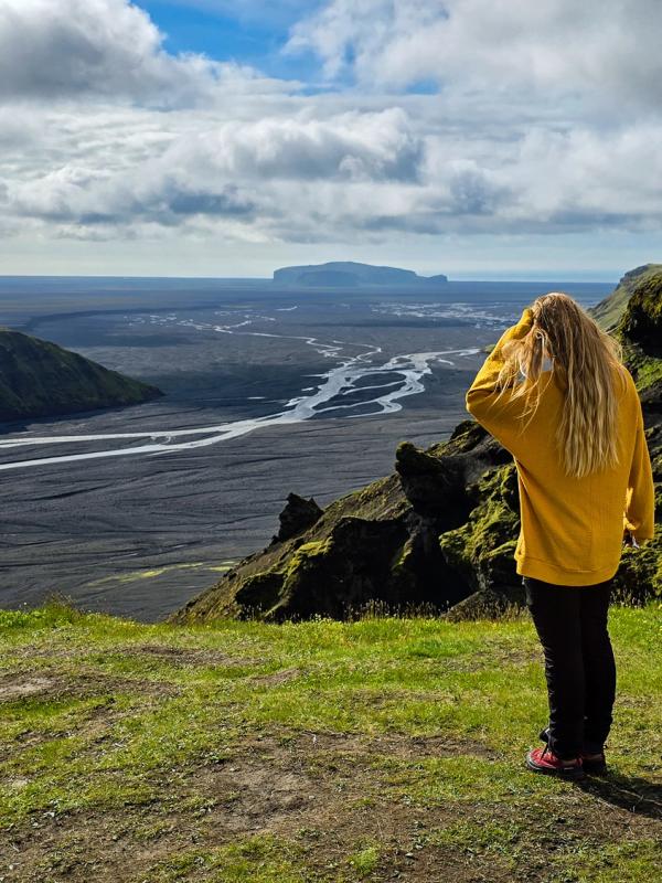
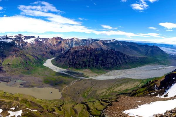
If Svartifoss is Skaftafell’s showstopper, then Morsárdalur is its slow-burn secret — a long, quiet trail that leads you deep into one of the most beautiful glacial valleys in Iceland. Here, braided rivers snake through wide plains, Arctic birch trees rustle in the breeze, and the sharp white threads of Morsárfoss — Iceland’s tallest waterfall — glimmer in the distance.
The hike begins like many others in the park but quickly leaves the crowds behind. It’s less about the summit or single view, and more about immersion in the wild glacial valley below Vatnajökull.
Though there are a few river crossings and route variations to consider, the terrain is mostly gentle, making it perfect for experienced hikers craving solitude without technical challenges. On a clear day, the mountains seem to unfold endlessly toward the ice cap. Bring lunch, take your time, and don’t expect cell service — this is a place to unplug completely.
3. Svínafellsjökull Glacier View (from Hotel Skaftafell)
Distance: 3.4km return hike (2.1 miles) Duration: 45–60 minutes Difficulty: Easy Start Point: Behind Hotel Skaftafell Parking: Free
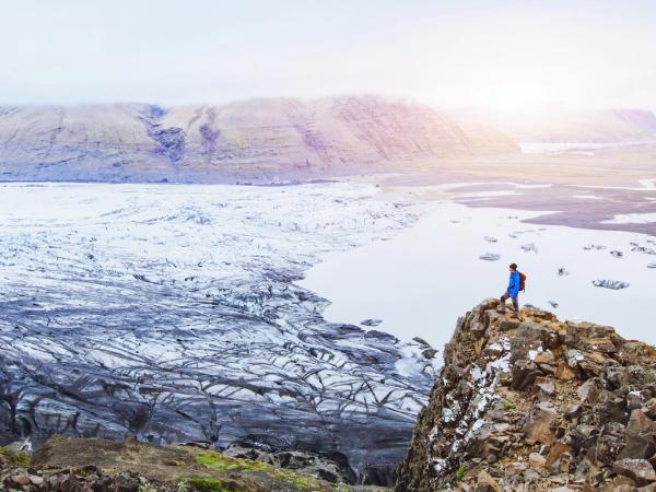
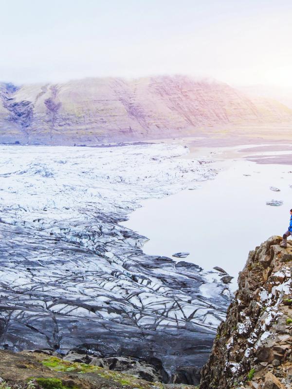
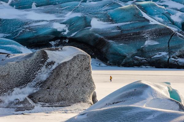
For a short walk with serious atmosphere, this is one of the best-kept secrets in the Skaftafell area. Tucked just behind Hotel Skaftafell, a quiet trail leads toward the snout of Svínafellsjökull — a creaking, fractured tongue of ice spilling down from the Vatnajökull ice cap.
Unlike the busy paths around Skaftafell’s visitor center, this one isn’t well known; you might not see another soul until you reach the glacier tongue itself. The trail curves through moraine and gravel hills, and in Spring, through a beautiful field of lupine flowers. The closer you get, the louder the glacier becomes: cracks, groans, the occasional distant rumble. It feels alive.
It’s not a long walk, but it’s a memorable one; especially when you reach the huge ridge of black sand with views over the glacier tongue. A perfect detour if you're overnighting nearby or need a peaceful stretch between bigger hikes.
4. Múlagljúfur Canyon
Distance: 5.8km return hike (3.6 miles) Duration: 2–4 hours Difficulty: Moderate Start Point: Gravel road off Route 1 near Fjallsárlón Parking: Free
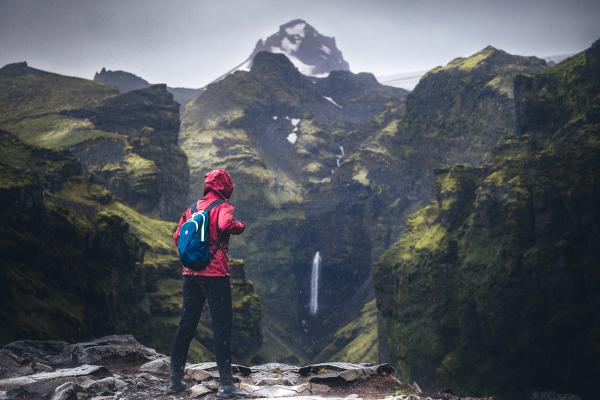
Tucked away in a quiet stretch of road just before you reach the glacier lagoons Jökulsárlón and Fjallsárlón, Múlagljúfur is one of Southeast Iceland’s most cinematic landscapes. While it’s growing in popularity, it’s still a place where remarkably few travelers pull over. A narrow path winds steeply uphill through mossy scrub, leading to a jaw-dropping viewpoint above a canyon so deep and dramatic it barely looks real.
From the top, you’ll see waterfalls cascading over sheer cliffs, with sharp, sawtooth peaks rising behind them. The canyon itself is draped in green and carved deep by glacial meltwater, creating a raw, powerful composition that feels more like Patagonia than Iceland.
This hike is short but steep in parts and best done in dry conditions. Bring good boots, a camera, and make sure to pay attention and be careful, as there are some sections that are slightly loose.
5. Vatnajökull Glacier Lagoons (Jökulsárlón to Breiðárlón to Fjallsárlón)
Distance: 15km one way (9.3 miles) Duration: 4–5 hours Difficulty: Moderate Start Point: Jökulsárlón or Fjallsárlón parking lot Parking: 1000 ISK (around $7 USD)
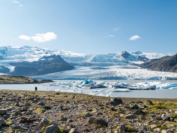
Everyone stops at either Jökulsarlon or Fjallsárlón – but not everyone knows that there’s a third glacier lagoon called Breiðárlón between the two that can only be reached on foot. This lesser-known trail connects all three of the glacier lagoons on a long hike, offering a big dose of ice, silence, and glacier views.
The route begins at either Jökulsárlón or Fjallsárlón and follows quiet gravel tracks and footpaths toward the hidden shores of Breiðárlón in between the two. Along the way, you’ll pass moss-covered hills, glacial moraines, and get to enjoy plenty of awesome views of the glacier above.
It’s a long, mostly flat walk through a haunting landscape that changes constantly with the light. Fewer people venture beyond Jökulsárlón itself, so there’s a good chance you’ll have long stretches of the trail to yourself. It’s a long one though, so having a pickup arranged at the other end is the easiest option. Otherwise, there’s a shorter 5.8km return hike (3.6 miles) to Breiðárlón from the Fjallsárlón parking area.
6. Hjallanes to Skálafellsjökull Viewpoint
Distance: 8.4km return hike (5.2 miles) Duration: 3–4 hours Difficulty: Moderate Start Point: Trailhead off Route 1, east of Höfn Parking: Free
For a quieter encounter with the glaciers of southeast Iceland, this loop trail above Hjallanes delivers sweeping solitude and some of the region’s most dramatic scenery. The hike begins on a jeep track skirting the lowlands before climbing gently up a moss-lined hillside dotted with wildflowers in summer.
As you gain elevation, the landscape expands: deep green valleys, glacial tongues twisting below, and the hulking mass of Vatnajökull behind it all. The highlight is Skálafellsjökull, an outlet glacier framed by sharp ridges, spilling slowly toward the plains. Many hikers recommend walking counterclockwise for the most rewarding views.
Expect some muddy patches, shallow stream crossings, and a few rocky sections – especially after rain – so good footwear and hiking poles are helpful. On a clear day, bring a windbreaker and plan to linger at the top.
7. Fláajökull Trail from Haukafell
Distance: 5–7km return hike (3.1–4.3 miles) Duration: 3–4 hours Difficulty: Moderate Start Point: Haukafell campground Parking: Free
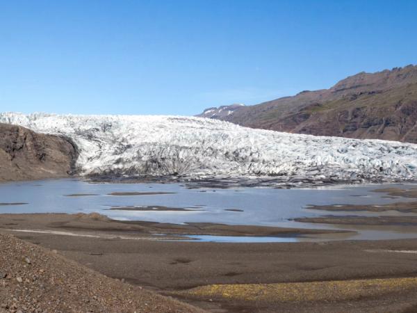
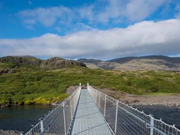
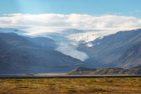
Fláajökull is one of the least visited outlet glaciers in southeast Iceland — which is precisely what makes this trail so special. Starting from the quiet Haukafell campground, the path heads toward the glacier along an easy-to-follow route through low brush and moraine, at one point crossing over a large suspension bridge.
There’s a stillness to the landscape here that feels different from other glacier walks. As you get nearer, you’ll turn a corner and the whole glacier will come into view, streaked with ash and textured like frozen waves, with a lagoon and large expanse of black dunes in front of the ice. Huge boulders are strewn across the side of the valley from rockfalls, and there are old, dinged signs in Iceland offering information about the area.
It’s not a technical hike, but it’s one that rewards slowness — binoculars are great for birdwatching, and the final viewpoint is perfect for sipping a hot drink while gazing at the ever-shifting edge of Vatnajökull.
8. Hvannagil Canyon Loop
Distance: 8.2km return hike (5 miles) Duration: 2–3 hours Difficulty: Moderate Start Point: Hvannagil area Parking: Free
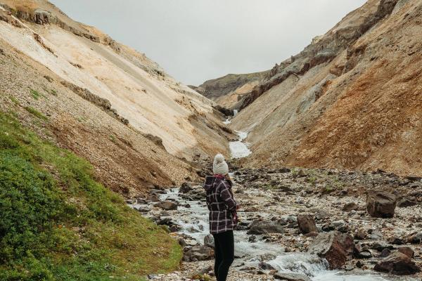
Tucked inland from Höfn, Hvannagil is one of southeast Iceland’s hidden gems that 99% of travelers drive right past. The colorful rhyolite canyon glows gold in the sun, with mineral streaks and formations that rival Landmannalaugar, but without the crowds or need for a 4x4.
The loop trail enters a steep-walled gorge where a glacial river winds through towering rock, before climbing out onto ridgelines and through remote rhyolite hills. Expect multiple stream crossings, some loose gravel, and a few moments of scrambling – especially if conditions are wet.
At its highest point, the views open wide across Vatnajökull’s southeast flanks and the quiet Lónsöræfi region. The route is lightly marked, so AllTrails or a GPS app is highly recommended. For those seeking color, solitude, and a sense of discovery, this trail delivers in spades.
When Is the Best Time to Hike in Vatnajökull National Park?
The ideal hiking season in Vatnajökull runs from late May through September, when snow has melted from most trails and highland access roads are open. July and August are the safest months for longer hikes like Morsárdalur or the Glacier Lagoon Loop, offering the warmest weather, longest days, and clearest paths.
Shoulder seasons in May and September can still be great, but check trail and weather conditions before setting off, especially for routes that may be affected by snowmelt or river crossings. Sites like vedur.is and road.is will help you plan around closures and forecasts.
What to Pack for Hiking in Vatnajökull
Iceland’s weather is famously changeable, even in summer. Whether you're out for an hour or a full-day trek, come prepared. Here's what to bring:
- Layered clothing: Always start with moisture-wicking base layers and finish with a wind- and waterproof shell.
- Good hiking shoes or boots: Trails can be muddy, rocky, or both.
- Hat, gloves, and warm mid-layer: Even in July, windchill can be sharp.
- Reusable water bottle: Glacier-fed streams are usually safe to drink from.
- Snacks or lunch: None of these trails have services.
- Map, GPS app, or route description: Trails are generally marked, but signage can be limited.
- Trekking poles (optional): Useful for longer hikes or uneven terrain.
- Towel and swimsuit: Handy if you're near any geothermal area or hot tubs (like Hoffell).
Conclusion
Vatnajökull’s trails are a hiker’s dream, blending glaciers, canyons, and epic views. From Svartifoss’s striking falls to Fláajökull’s serene solitude, these eight routes let you feel Iceland’s wild pulse. Pack layers, check the forecast, and dive into the adventure.

