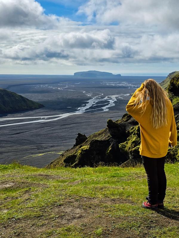
The 10 Best Hikes in South Iceland: From Hot Rivers to Glacier Trails
South Iceland isn’t just one of the most popular regions for road trippers — it’s also a hiker’s dream. Between the towering glaciers, steaming geothermal valleys, and volcanic coastlines, you’ll find trails that are short and sweet, long and challenging, and everything in between.
Whether you’re soaking in a hot spring after a muddy climb or standing on a cliff watching puffins wheel through the wind, these hikes let you see Iceland from a slower, more personal perspective. Most can be tackled in a few hours or less, making them ideal adventures into nature while travelling through Iceland’s South Coast.
Map of the Best Hikes in South Iceland
Use the interactive map below to get your bearings. We’ve pinned all eight trailheads to make your planning easy – each pin also has information about trail length, altitude gain, and whether you have to pay for parking or not.
The Top Hikes in South Iceland
Let’s get stuck in; here are the best places to stretch your legs and immerse yourself in nature in the south.
1. Reykjadalur Hot Spring River
Distance: 9 km return (5.6 miles)
Duration: 2–3 hours
Difficulty: Moderate
Start Point: Reykjadalur car park, Hveragerði
Parking: 200 ISK for the first hour, 250 ISK every hour after that.
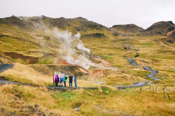
Just outside the town of Hveragerði, Reykjadalur is one of the easiest ways to dip into Iceland’s geothermal energy. Reykjadalur means “Steam Valley” in English, and it’s exactly that – a place where hot water bubbles from the earth, mud pots bubble, and steam billows out of the hillside.
The trail starts at a car park behind town and winds uphill along a well-marked path, passing bubbling mud pots and sulfur vents. After about 45–60 minutes of steady walking, you’ll reach the warm river where people bathe year-round.
There are no changing rooms at the hot spring, just some wooden partitions that provide a bit of privacy for slipping in and out of your bathing suit. But that’s part of the charm. Bring a towel, a dry bag, and take your time soaking. In summer, this is a great hike to do later in the evening or early morning, as it can get quite crowded during the day.
2. Miðskálagil Canyon Hike
Distance: 5.1 km return (3.2 miles)
Duration: 1.5–2 hours
Difficulty: Moderate
Start Point: Ásólfsskáli Church, just off Route 246
Parking: Free
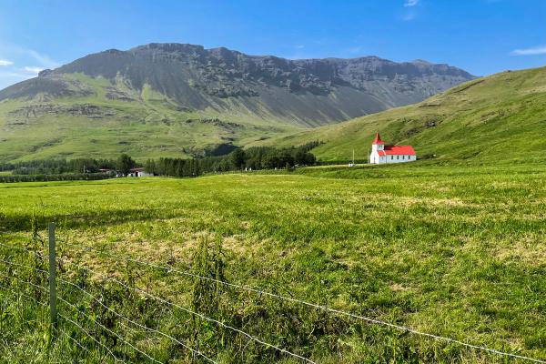
Tucked in between Vík and Skógar, this little-known trail starts just behind Skálakot Manor and leads you into the heart of a narrow, dramatic canyon. The route begins at a small church near the farm, where you’ll follow the dirt roads toward the canyon behind the farms. From here, the trail quickly ramps up as you cross a footbridge and begin the steady climb into the hills.
The initial ascent is the steepest section, with some tight switchbacks and muddy patches if it’s been raining. But the reward is a bird’s-eye view into the snaking Miðskálagil canyon and its hidden waterfall, churning far below in the gorge. It’s not a trail for anyone nervous around heights, but for those who make it to the overlook, the view feels like a secret.
Early summer is best for this hike, when the river’s flowing strong and the greenery in the canyon is vivid against the dark rock. If you want to hike somewhere quiet and beautiful without detouring far from the Ring Road, this is a perfect pick.
3. Fimmvörðuháls Pass
Distance: 23.5km one way (14.6 miles)
Duration: 8–12 hours
Difficulty: Challenging
Start Point: Skógafoss (or Thórsmörk if done in reverse)
Parking: 1000 ISK
This is the biggest and best hike in South Iceland in our opinion, stitching together two of Iceland’s most beautiful sights: Skógafoss Waterfall and the Thórsmörk Nature Reserve. Over 25km, the trail climbs past nearly two dozen waterfalls on the trail leading north from Skógafoss before cresting between the glaciers Eyjafjallajökull and Mýrdalsjökull.
This hike isn’t easy – you’ll need good weather and solid gear, as well as a plan for when you arrive in Thórsmörk. But if the conditions line up, this is one of the most rewarding single-day hikes in the country. You can hike Fimmvörðuháls Pass if you have a rented vehicle as well, as there are places to leave it parked on the south coast.
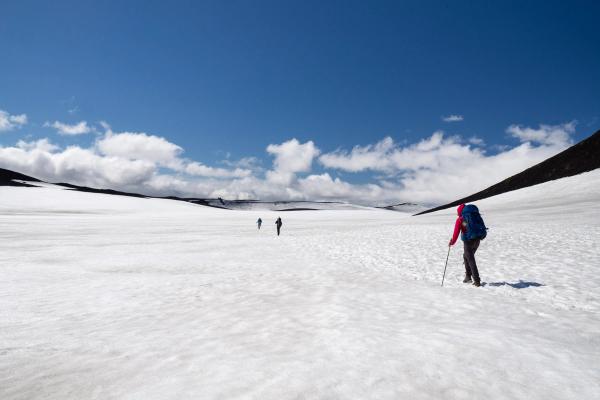
Highlights include the eerie lava formations of Magni and Móði – cones born from the 2010 eruption of Eyjafjallajökull – and the shifting, surreal snowfields near the pass. Then there’s Thórsmörk Nature Reserve itself, one of the most stunning areas in Iceland, filled with basalt canyons, black sand braided by glacial rivers, and superb views of the glaciers above.
4. Glacier Hike on Sólheimajökull
Distance: 2–4 km on ice
Duration: 3 hours
Difficulty: Moderate (with guide)
Start Point: Sólheimajökull glacier parking area
Parking: 750 ISK
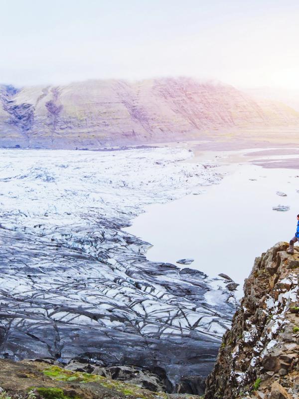
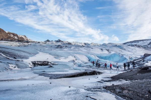
While not a traditional hiking trail, hiking on a glacier is one of the most unique ways to explore Iceland’s raw geology. Sólheimajökull is one of the most accessible options for beginners, and a great addition to any itinerary along Iceland’s South Coast.
You’ll need to book a guided tour (no exceptions here – glacier travel is dangerous without one), but once you’re geared up with crampons and an ice axe, the world changes. Blue crevasses, jagged ridges, and deep moulins carve the landscape into an alien terrain. Sólheimajökull is a regular shooting location for films and TV series, and the blue ice here features streaks of black, ash from previous eruptions of Katla, the volcano that lies beneath Mýrdalsjökull.
The hikes here will differ depending on the weather and what season it is, but you’ll always walk away with a new appreciation for just how alive a glacier can be and how fast they’re changing.
5. Reynisfjall Cliff from Vík
Distance: 7 km round trip (4.3 miles)
Duration: 1.5–2 hours
Difficulty: Moderate
Start Point: Vík town edge
Parking: Free
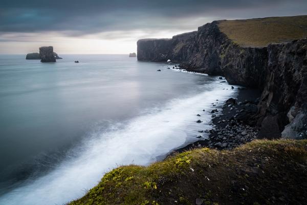
If you’re staying the night in Vík, this short, steep hike makes for a perfect evening outing in summer, when you can catch a beautiful golden hour and sunset. Starting from the edge of town, the trail climbs Reynisfjall, the headland above both the black sand beach in Vik and Reynisfjara on the other side. It’s steep, but once you’re up the top, things flatten out and are quite easy.
Awaiting you at the tip of the peninsula are some astounding views over Reynisfjara and the Reynisdrangar sea stacks. In summer, the cliffs are also home to puffins, who flap in and out of their burrows like nervous little comedians. Just be careful near the edge — there are no fences here, and the drop is steep.
6. Hjörleifshöfði
Distance: 3.4 km round trip (2.1 miles)
Duration: 1–1.5 hours
Difficulty: Easy to Moderate
Start Point: Hjörleifshöfði parking area
Parking: 1000 ISK
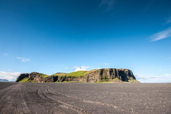
Just after exiting Vik to the east along the Ring Road, there’s a small detour to the south that contains another special hike in the region. A bumpy, gravel road leads you to a grassy headland called Hjörleifshöfði, resembling an island rising up in a sea of black sand. Before hiking up to the top, make sure to wander around to the south side of the outcrop, where you’ll find the “Yoda Cave” – where from inside the cave, the rocks resemble the Jedi master’s head.
The hike to the top is quite easy, with a steep start, but things level off soon afterward. Up top, you’ll find the ruins of a historic farm and sweeping views over the surrounding Mýrdalssandur, a huge black sand beach created by glacial floods washing down from Mýrdalsjökull. It feels lonely in the best possible way.
This particular place has an interesting history; it’s named after Hjörleifur Hróðmarsson, the second cousin and brother-in-law of Ingólfur Arnarson, who is widely considered to be the first permanent settler in Iceland when he arrived around 874 AD. Hjörleifur sailed to Iceland with Ingólfur and set up a small farm on this outcrop, but he and his men were murdered by their slaves, who then fled south to the Westman Islands. There, they were tracked down and killed by Ingólfur after he discovered the murdered Hjörleifur, but not before he laid his blood brother to rest in a burial mound at the top of Hjörleifshöfði.
7. Thakgil Canyon Loop
Distance: 15.3 or 19.7 km loop (9.5 or 12.2 miles, depending on return route)
Duration: 8–10 hours
Difficulty: Challenging
Start Point: Thakgil Campsite
Parking: Free
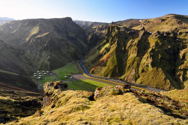
Hidden away in a lush green canyon between Vík and Mýrdalssandur’s black sands, Thakgil is one of South Iceland’s best-kept hiking secrets. From the small Thakgil campsite, an adventurous loop hike climbs through wild ravines and ridgelines overlooking glaciers, waterfalls, and sprawling black deserts.
The best route links the eastern half of the Yellow Trail with the western section of the Red Trail, creating a full loop. You’ll start with a steady climb through mossy valleys, rewarded quickly with huge views over Kötlujökull Glacier and the surreal volcanic landscapes. If you’re feeling extra adventurous, you can detour off the marked trails to reach the edge of the hidden Huldujökull Glacier.
After skirting the ridgeline, you can either return to Thakgil via the rough jeep track (easier and faster) or continue onto the Red Trail for a more rugged finish through deep canyons and exposed ridges. Expect some steep sections, river crossings (if following the full red trail), and hardly any other soul.
The trail is best in clear, calm weather – fog, rain, or strong winds can make parts of the ridgeline dangerous. In good conditions, though, this is one of the most unforgettable day hikes on the South Coast. Best done with hiking poles and a windproof jacket.
8. Fjaðrárgljúfur Canyon
Distance: 3.4 km round trip (2.1 miles)
Duration: 1–1.5 hours
Difficulty: Easy
Start Point: Fjaðrárgljúfur parking area
Parking: 1000 ISK
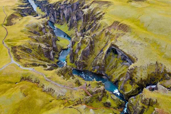
Fjaðrárgljúfur is more of a meander than a hike, but its beauty earns it a place on this list. A short, well-maintained trail runs alongside this beautiful canyon’s edge, offering several viewpoints where the moss-draped cliffs plunge into the winding river far below.
The whole loop takes less than an hour, but you’ll want to linger a bit longer at the various viewpoints to take in the canyon. This place looks like it belongs in a fantasy film — which is exactly why it became Insta-famous a few years back (and also in part to the music video to I’ll Show You by Justin Bieber). Thankfully, better infrastructure and some seasonal closures have helped reduce the strain on the environment from tourism, as it is a wildly popular stop along the Ring Road.
Because of the crowds, if you arrive early or late, you’ll have a quieter experience; nearby Kirkjubæjarklaustur is just 10 minutes away and has a good campsite and some hotels and guesthouses as well.
9. Svartifoss Waterfall
Distance: 3.4 km round trip (2.1 miles)
Duration: 1–2 hours
Difficulty: Moderate
Start Point: Skaftafell Visitor Centre
Parking: 1000 ISK
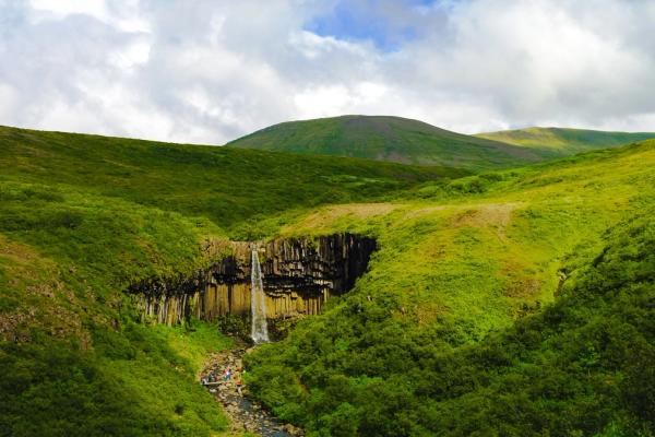
Located in Vatnajökull National Park, Svartifoss (“Black Falls”) is famous for the basalt columns that frame its cascade shooting off the cliff. This is the most popular of several hiking routes in Skaftafell, and delivers big on beautiful landscapes and views in a short time. The hike up from the Skaftafell visitor centre is about 1.7km each way and climbs steadily through birch and heath.
Along the route, you’ll pass a few smaller falls and scenic viewpoints before arriving at Svartifoss itself, where a viewing platform lets you appreciate the symmetry and power of the scene.
It’s a great leg-stretcher between long driving days, especially if you’re heading towards the Jökulsárlón Glacier Lagoon and Diamond Beach. And if you’re feeling energetic, you can extend the hike into longer loops that offer glacier views and even more solitude, as most people will turn back after Svartifoss.
10. Eldfell Volcano
Distance: 2.6 km round trip (1.6 miles)
Duration: 1.5–2 hours
Difficulty: Moderate
Start Point: Eldfell trailhead, Heimaey
Parking: Free
Heimaey Island, part of the Westman Islands archipelago, is a detour worth making in any season, but especially in summer, when the ferries run often and the weather plays nice.
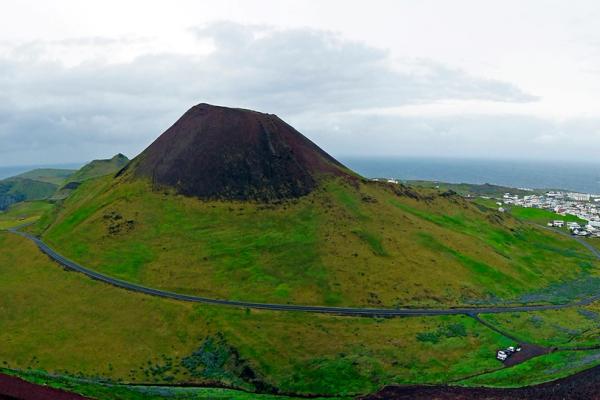
Eldfell, the volcano that erupted suddenly in 1973, is the island’s defining feature. The trail to the top is a short but steep climb over red ash and loose gravel. At the summit, you’ll find vents that still steam and panoramic views over the island, its lava fields, and the distant mainland.
What makes this hike special is the sense of walking through living history. The eruption reshaped the island and forced a full evacuation, and signs of that drama are still everywhere — half-buried houses, hardened flows, and a museum built into the edge of the lava itself.
When Is the Best Time to Hike in South Iceland?
The best time to hike in South Iceland is from June through September, when trails are clear of snow and the days stretch long under the midnight sun. July and August offer the most stable weather, ideal for tackling bigger routes like Fimmvörðuháls.
If you’re visiting in May or late September, in general, these hikes are still accessible — especially the lower-elevation ones like Svartifoss or Reykjadalur — but you’ll want to keep a close eye on weather forecasts, trail conditions, and road closures.
What to Pack for Hiking in South Iceland
Even on short trails, Iceland’s wild weather means packing smart. Here’s what we recommend for these great hikes in South Iceland.
- Layers: Start with a moisture-wicking base, add a fleece or insulated mid-layer, and finish with a waterproof shell. South Iceland is one of the rainiest regions in the country.
- Good footwear: Sturdy hiking boots are usually what people opt for – but if you’re visiting in summer when the trails are clear, then some good trail runners are perfectly fine as well.
- Hat and gloves: These are a must in Iceland at all times of year and for whatever activity you’re doing. Even in July, the wind can have a real bite to it.
- Reusable water bottle: Of course, part of being a good traveler in Iceland is taking your reusable water bottle with you and filling as you go. Some of these hikes you might even fid a stream you can fill up your water bottle from.
- Snacks or lunch: Hiking trails in Iceland aren’t exactly known for their services – it’s good to take something to eat with you.
- Map or GPS app: Trails are usually well-marked, but it’s good to have a backup. For these hikes, having some version of an offline map should be fine.
- Towel and swimsuit: Essential for Reykjadalur or any nearby hot spring soak.
For glacier hikes, all technical gear is provided by the tour operator — just bring warm socks and wear layers you can move in. If your footwear isn’t suitable for the glacier, then you can rent boots from the tour operators as well.
Hiking in South Iceland
South Iceland may be known for its roadside sights, but step away from the car and you’ll find something richer: trails that take you up, in, and through the land. Some are soft and slow. Others are steep and raw. But all of them leave a mark.
So lace up your boots, stash some snacks in the glovebox, and make time for at least one of these hikes. You’ll see a different side of Iceland — not just through the windshield, but beneath your feet.

